It helps when you have a goal to be able to visualise your progress towards it.
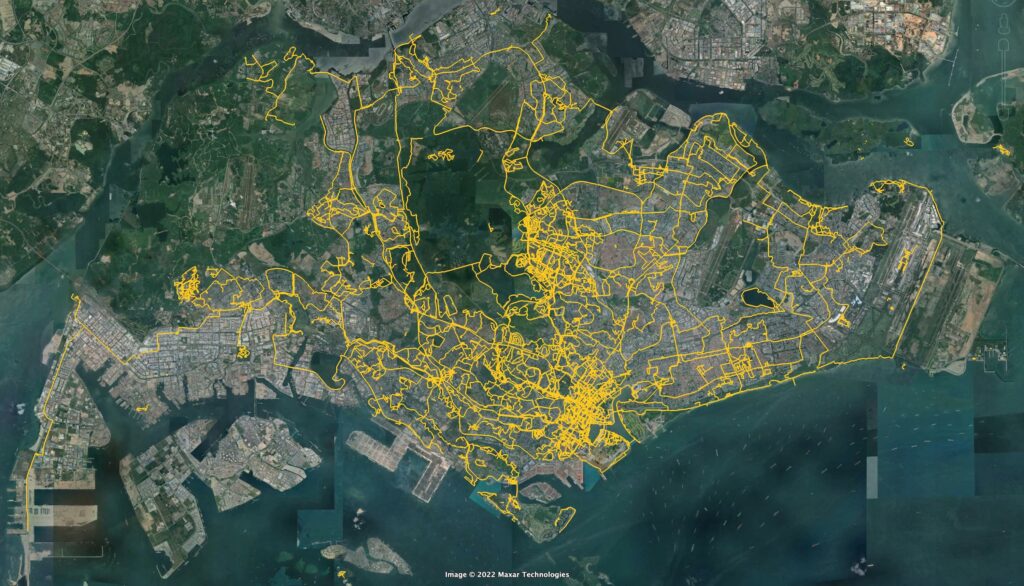
Here is my walking map. It’s a map I’ve created using Google Earth Pro, showing every place in Singapore I’ve walked so far, last updated 31 Dec 2022.

The yellow lines are paths I’ve placed manually to indicate everywhere I’ve walked.
I’ve included both walks I’ve been on only for the sake of walking, and walks I’ve taken to get to places – for example, to the supermarket, or to work.
Any paths I might have cycled are excluded, which is why Pulau Ubin looks so disappointingly blank.
Lines were drawn manually and progressively from 2015. Walks prior to 2015 were added to the best of my memory. Where uncertain, I erred on the conservative side, and excluded any sections of the walk I was unsure of.
Leave a Reply