Back in 2022 I went for a rather interesting walk in Loyang. This was before I had any idea of starting a blog about walking, and so I didn’t take very many photos. Nevertheless, it’s an interesting walk, and it seems a shame not to share it. So I’m trying a slightly different format for this blog post, where I’ll describe the route I took first, before writing a bit about some of the interesting spots I passed through.
The Route
My walk started at Tampines East MRT station, which I’d passed by on a previous walk in Tampines, heading northeast along Tampines Avenue 7, until I passed under Loyang Flyover and onto Loyang Avenue. I stayed on Loyang Avenue only a short while before turning left down Pasir Ris Drive 1, and then right onto Pasir Ris Drive 2. I followed Pasir Ris Drive 2 northeastward again, past Loyang Point mall, before arriving on Loyang Way.
I continued northeastward down Loyang Way, past Loyang Bus Depot, and through Loyang Industrial estate. At some point, I encountered a fork, with one branch of Loyang Way continuing straight northeastward, and another branch turning 90 degrees to the right and intersecting Loyang Avenue. I took the latter branch, across Loyang Avenue, past the entrance to Selarang Camp, following the curve of the road until it morphed into Upper Changi Road North.
Instead of taking Upper Changi Road North, I turned left onto a much smaller road, Abingdon Road. I wandered down this narrow, tree-lined lane, taking a quick pause near its end, close to the perimeter fence of Changi Airport. Then I continued down the road onto Cosford Road, following this past the Johore Battery, back onto Upper Changi Road North.
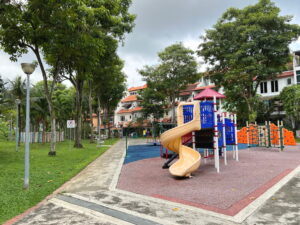
I turned left and headed down Upper Changi Road North, past Toh Avenue and Toh Drive, making a quick detour into Changi Height Playground for a water break. I then continued on my way past Old Tampines Road, turning right onto Jalan Miriam and passing a little way through that estate. Exiting it and its northwestern end, I crossed Old Tampines Road a second time, and followed New Loyang Link briefly before turning into Loyang Rise and Loyang View estate. Here, I took another quick break in a playground, before exiting the estate onto Loyang Avenue.
Crossing Loyang Avenue, I sliced briefly through the HDB estate, walking under the HDB blocks, until I arrived at Pasir Ris Street 21. This I followed across Pasir Ris Drive 2, intersecting my route earlier during the walk. The original plan had been to pop by Nautica Park, but this was closed for renovation, so I followed Pasir Ris Street 21 a bit more before heading into the void decks again, emerging on the other side at Pasir Ris Drive 4, which I crossed, taking me into Sea Shell Park.
The final stretch of the walk took me past Sea Shell Park and across Pasir Rise Drive 6, passing under void decks yet again till I arrived at Time Park. From here, I exited onto Tampines Park Connector, crossing Sungei Tampines and heading into Pasir Ris Town Park. I made my way through the park towards Pasir Ris MRT station, where my walk ended.
Loyang Avenue, and how Loyang got its name
At the time of writing, an extensive viaduct is being constructed over Loyang Avenue which is meant to relieve some of the traffic of Loyang Avenue by providing an alternative connection between Loyang Flyover and Changi Village. Construction was already under way when I did this walk, but was still in the relatively early stages, and blue skies remained over the entirety of Loyang Avenue that I could see.
The name Loyang seems to have come from Sungei Loyang, a river that emptied into the Johor Strait somewhere close to the eastern end of Pasir Ris Park today. For a time street maps showed it running adjacent to a canal beginning just north of Masjid Al-Istighfar on Pasir Ris Drive 3, until it disappeared in the 2007 edition.
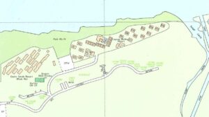
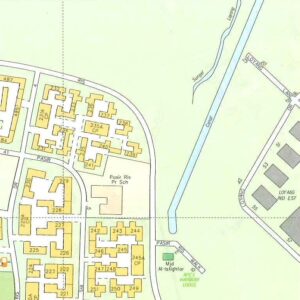
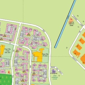
The earliest mention of this river I could find was in an article in the Singapore Free Press in 1848, which mentioned a survey down of streams and creeks by the colonial Government Surveyor. This described a Sungei Loiung, a narrow channel of water that apparently ran dry during low tide, and featured neither inhabitants nor cultivation.
“Loyang” itself is Malay for “brass”, and apparently describes the colour of the water that ran in the Sungei Loyang. I did find one Berita Harian article from 1992 which provides an alternative to this explanation. The article tells of a couple, Haji Manan and his wife Tongkong, who lived in a kampong near where the Downtown East chalets are today. This couple had three daughters, named Hijau, Munah, and Timah. since Hijau was a bit of a strange name, the villagers gave the first daughter the name “Loyang” instead. Over time, the kampong itself came to be known as Kampong Loyang, and the rest is history.
I’m somewhat doubtful of this story. The article itself acknowledges that it’s unclear why Hijau was given the name “Loyang”. And the story ignores the fact that there was already a Sungei Loyang in 1848, whose banks were apparently uninhabited at the time. Nevertheless, an interesting bit of folk toponymy.
Pasir Ris Drive 1 and Drive 2
I’ll save a proper write-up on Pasir Ris for another time, perhaps a walk dedicated to this neighbourhood. Suffice to say the first mention of Pasir Ris I was able to find in the press was in a March 1896 article, reporting on a military exercise held there.
Pasir Ris New Town as we know it today began its life with a series of land acquisitions beginning in 1983, with plans announced for a new HDB estate there with 40,000 units of flats, and construction then slated to start in 1985 or 1986.
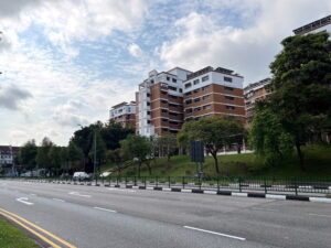
I wasn’t able to establish when the bit of Pasir Ris I was now walking through was built. I imagine it must have sprung into existence some time between 1993 and 1995, as evidenced by its absence in the 1993 edition of the Singapore Street map, and its appearance in the next edition in 1995. A 1995 newspaper article described one family moving into their flat on Pasir Ris Street 13 “two years ago”.
Loyang Industrial Estate and Loyang Tua Pek Kong Temple
Unfortunately, I neglected to take any photos of this place as I was passing through it.
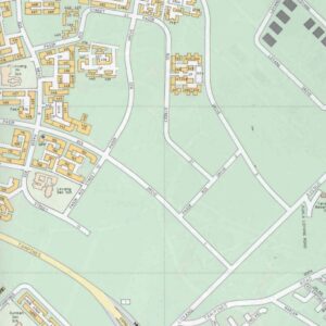
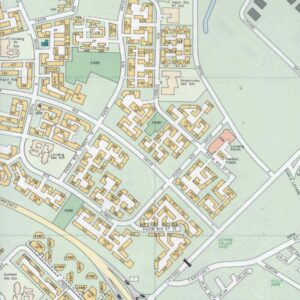
Loyang Industrial Estate was conceived in the early 1970s to address a burgeoning demand for industrial space in Singapore. Despite an increase in available industrial land in Singapore to 5598 acres by 1971, the need for more industrial facilities remained strong, spurring the development of Loyang by the Jurong Town Corporation (JTC). This would be the 19th industrial estate in Singapore developed by JTC.
Development began in late 1974, with plans for the estate to initially cover 105 hectares, although a second phase would begin in 1979, aiming to bring the total to 193 hectares by 1984. With what was then a hefty budget of $70 million, the estate was equipped with advanced infrastructure, including eight “Type 6” factories built by JTC, each boasting a floor area of 900 square meters. These factories, the largest standard type built by JTC at the time, were designed to support a variety of industrial activities.
Loyang’s industrial focus lay initially in the aviation sector, with industries planned to include the manufacture and maintenance of aircraft components. Later, this expanded to accommodate a broader range of high-tech industries, including servicing for the civil engineering industry, the production of offshore oil exploration equipment, and engineering fabrication for agricultural products and mineral development, reflecting the dynamic economic landscape of Singapore.
The estate was part of a broader strategy to attract high-tech manufacturing and service industries. Strategically located near the newly constructed Changi International Airport, Loyang was planned as a modern engineering service and supply base catering to both regional and international markets. The estate’s proximity to key transport links, including the Pan Island Expressway (PIE) and nearby housing estates in Tampines and Bedok, was also intended to provide a substantial labour pool, with an estimated 400,000 workers in the surrounding districts.
During my walk through the estate, I came across the impressive Loyang Tua Pek Kong Temple. This grand, multi-faith temple is unique in that it enshrines deities from various religions, including Taoism, Buddhism, Hinduism, and Datuk Kong. The latter is a fascinating religious practice unique to Chinese communities in Malaysia and Singapore, involving the worship of guardian spirits.
Selarang Camp
As I followed that one branch of Loyang Way across Loyang Avenue, I passed by the entrance to Selarang Camp.
Selarang Camp began its life as Selarang Barracks, built between 1936 and 1938 to house soldiers from the 2nd Gordon Highlanders Battalion. However, the camp has a darker history. During the Japanese Occupation in WWII, it was taken over by the Japanese Imperial Army and used as a prison camp for Australian and British POWs.
The camp is infamous for what is now known as the Selarang Barracks incident. In 1942, four POWs attempted to escape but were captured. To prevent further escape attempts, the Japanese tried to force all POWs to sign a non-escape pledge, which violated the Geneva Convention, granting POWs the right to escape. Naturally, they refused.
To coerce compliance, the Japanese crammed 15,000 men, including POWs from Changi Camp, into barracks designed for 800-1200. They cut off water to the toilets, leading to a severe deterioration in sanitary conditions, with outbreaks of dysentery and diphtheria. Eventually, the Japanese cut off water entirely and halved the rations. This was the breaking point. Colonel E. B. Holmes ordered the POWs to sign the non-escape documents. On September 5, 1942, many prisoners signed under false names. Following this, the prisoners were returned to their original barracks.
After the war, the barracks housed Australian Army units of ANZUK, a tripartite force formed by Australia, New Zealand, and the United Kingdom to defend the Asia-Pacific region. Today, the camp is home to Singapore’s HQ 9th Infantry Division and the 3rd Battalion Singapore Infantry Regiment. During the COVID-19 pandemic, the camp reportedly served as a holding area where pre-enlistees were screened for COVID symptoms and said farewell to family members before being transported to Pulau Tekong.
Selarang Park Complex
Passing by Selarang Camp, I encountered another large, secured facility, this time operated by the Singapore Prison Service (SPS), and known as Selarang Park Complex. This complex housed, amongst other things, the Selarang Halfway House, whose entrance I passed by as I turned left onto Abingdon Road.
Selarang Halfway House is home to SPS’s Halfway House Scheme (HHS), which helps inmates transition back into society. Inmates here get access to various programs, like counseling and job training, designed to support their reintegration. The goal is to provide a structured environment that helps them gradually adjust to life outside, with support from community partners.
The HHS is just one of the three schemes under the SPS’s Community-Based Programmes. These programs aim to help inmates reconnect with their families and develop job skills, making it easier for them to reintegrate into society. You can find more details about these initiatives on the SPS website.
Abingdon and Cosford Roads
As I turned off Loyang Way and headed up Abingdon Road, another, even smaller road, comprising just a single, tree-lined lane. This led me past several other facilities, all unmarked and very discreet-looking. Given the proximity of the area to Changi Airport, I sort of assumed these were all facilities related to aviation.
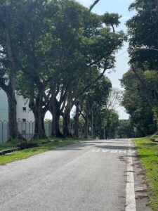
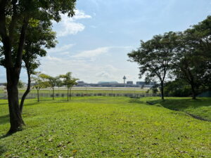
At the end of Abingdon Road lay a cluster of trees growing on a patch of greenery, sitting right across the perimeter fence from one of Changi Airport’s runways. I took a quick break there, standing and watching several planes as they taxied their way onto or off or past the runway. You could see part of Terminal 3, and even the top of Jewel peaking out over it. I didn’t stay long, feeling a little paranoid about being questioned by security.
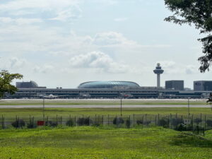
Abingdon Road and Cosford Road are both named after RAF bases in the UK, Abingdon being named after RAF Abingdon (now Dalton Barracks) in Oxfordshire, and Cosford after RAF Cosford in Warwickshire.
In fact, other streets in the area bear such names. Most but not all lie within restricted areas, primarily within Changi Airbase, and so are not accessible to the general public. Examples include Debden Road, named after RAF Debden in Essex, Lyneham Road, named after RAF Lyneham in Wiltshire, Honington Road, named after RAF Honington in Suffolk, Cottesmore Road, named after RAF Cottesmore in Rutland, and Kenley Road, named after RAF Kenley in London.
Johore Battery
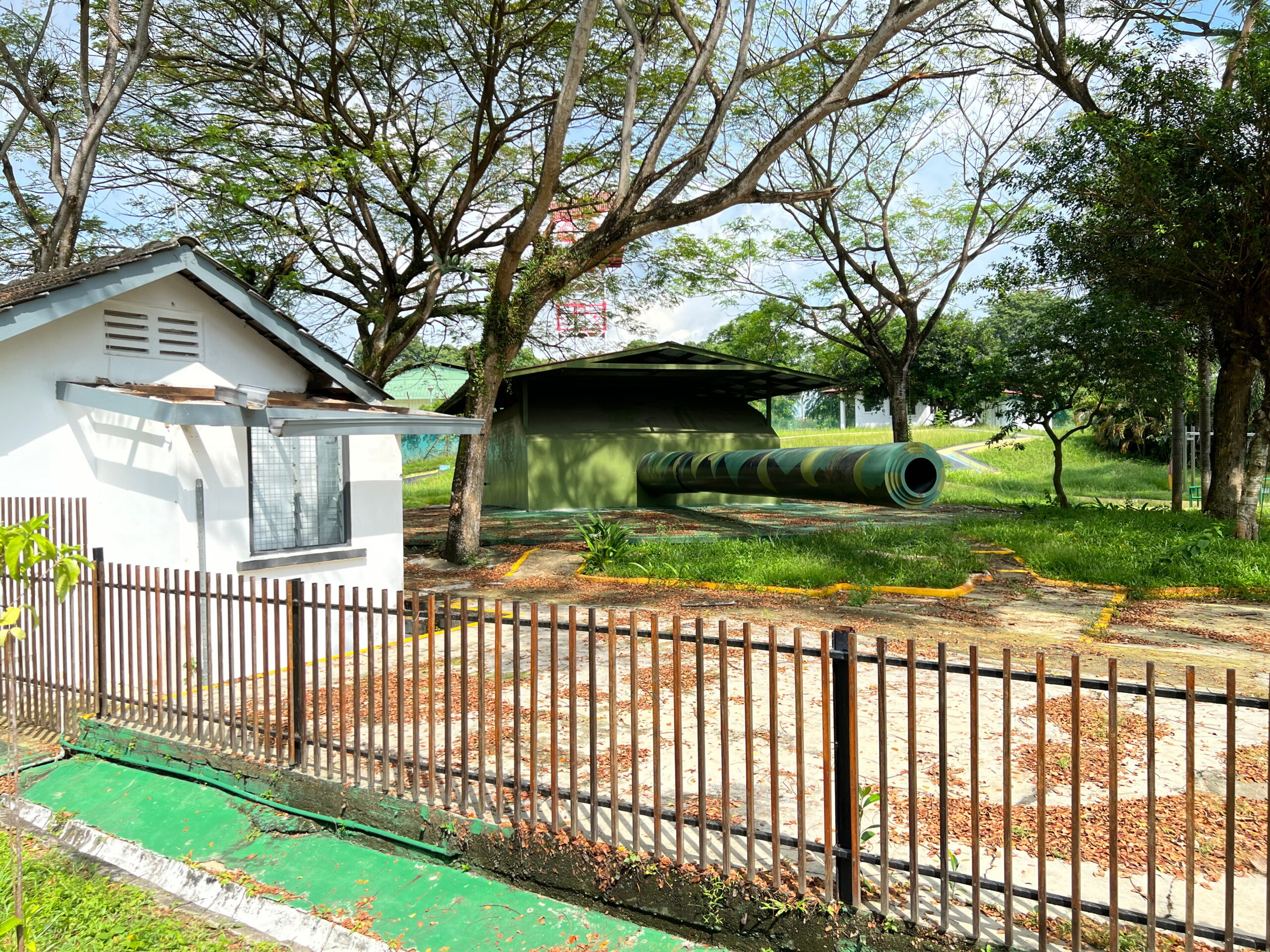
On Cosford Road I passed by a historical site I had not even known existed until now, the Johore Battery. Constructed in the late 1930s, the Johore Battery was a key component of the British coastal artillery defence network, placed at this location to protect Sembawang Naval Base further west along the Johor Strait.
The Johore Battery’s guns were known as “15-inch guns” because they fired shells with a 15-inch (38 cm) diameter. These were designed to turn 360 degrees, enabling them to fire or targets on both land and sea, although they were less effective against enemy forces approaching from land, as its armour-piercing ammunition tended not to detonate when impacting soft land.
Retreating British forces destroyed the guns at the Johore Battery to prevent them from falling into Japanese hands, and the Battery itself faded into obscurity after the British left Singapore, until it was rediscovered in 1991, during routine cleaning here by SPS. The site was then refurbished and a replica of one of the 15-inch guns which once sat hear installed. The restored Johore Battery was inaugurated on 15 February 2002, on the 60th anniversary of the Fall of Singapore.
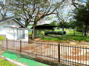
Unfortunately, the place didn’t appear open during my walk, and reviews online didn’t seem to suggest it was really worth going out of the way for a visit. Perhaps if I were a WWII history fanatic, it might be. More photos can be found at the Long and Winding Road blog.
Changi Prison and Changi Chapel & Museum
I won’t say much about Changi Prison and Changi Chapel and Museum, because both are major landmarks, and information about them can easily be found online. Perhaps I might write more if I ever actually visited the latter.
Suffice to say Changi Prison was originally completed in 1936, the last prison to be built by the British colonial government. It served as an internment camp during WWII, and it is this aspect of its history which the Changi Chapel and Museum speaks to today.
The modern prison complex was built on the site of the old one, opening in two phases in 2004 and 2010.
Toh Estate, Jalan Sinar Bintang and Bular, Bukit Loyang Miriam, and Loyang Villas
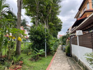
As I headed back towards Pasir Ris, I first passed by three different private housing estates. The first was Toh Estate. The first was Toh estate, which called to mind Toh Tuck and Toh Yi, comprising streets named Toh: Toh Crescent, Toh Avenue, Toh Street, Toh Drive, and Toh Heights. These called to mind streets I’d written about in my last post on Eng Kong and Cheng Soon estates. The Toh roads here, however, are named after Toh Chin Joo and Toh Chi Ghee, a father-son pair who arrived in Singapore from Fujian Province in China, and were engaged in the transportation and construction business. It was they who apparently developed this estate.
The next three estates I didn’t actually managed to learn much about. The first comprised just one pair of roads, these ones having quite romantic names: Sinar Bintang, meaning “starlight”, and Sinar Bulan, meaning “moonlight”.
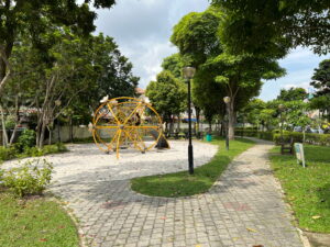
The second was Bukit Loyang Miriam. Jalan Miriam is one of the older residential streets in the area. It first appears in the 1966 edition of the Singapore topographical map. I wasn’t able to learn who the eponymous Miriam might have been. I did find this rather riveting newspaper article, though, telling the story of a drug smuggling operation gone wrong, a betrayal, a murder in England, an a fugitive hiding out in none other than Jalan Miriam.
The third and final estate was Loyang Villas, an estate developed in the mid-1990s, and advertised as featuring “Peranakan-style” houses. I only saw this advertisement after my walk, and neither noticed nor photographed any such houses during my walk. You can see them on Google Street View. I won’t comment on the authenticity of these so-called Peranakan-style designs.
Pasir Ris’ neighbourhood parks
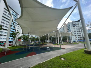
As I wrote earlier, I’ll save a proper write-up on Pasir Ris for another time. However, as I aimed to cut across Pasir Ris to get to Pasir Ris MRT station, where I would end my walk and head home, I thought I would make a visit to several neighbourhood parks in Pasir Ris along the way.
I did not realise it at the time, but there seems to be a nautical theme running through several of the parks in the area. Had I known, I would have made a deliberate effort to visit each of them. Instead, I more or less merely looked at my map and picked a few parks to visit that were between me and the MRT station.
The first park I aimed to visit was by sheer coincidence one of these nautical parks, and indeed was called “Nautical Park”, on Pasir Ris Street 21. Unfortunately, this park turned out to be closed for redevelopment at the time, and so I had to pass it right by. It seems to have been completed at some point in 2023, though.
I had better luck with the second park, which was also nautical-themed. This was Sea Shell Park, located along Pasir Ris Drive 4. This park was opened on 23 January 1995, and is filled with sea creature motifs, with an amphitheatre resembling a viking ship.
Reading up on Sea Shell Park, I found a rather interesting article from 1996, describing a plan by the Singapore Tourism Board (STB) to promote Singapore’s HDB heartlands as tourist destinations, off the well-worn track of Orchard Road, Sentosa, and Mount Faber. Sea Shell Park was mentioned as a possible attraction in Pasir Ris, alongside the Tibetan Sakya Tenphel Ling temple, just adjacent, and the larger Pasir Ris Park. The idea that Singapore’s heartlands are places to discover and explore appeals to me, and is part of the premise behind my doing these walks, it doesn’t seem to me that these plans were implemented with much success, given I’ve heard nothing of them.
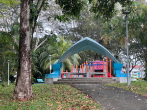
The remaining nautical-themed parks, unfortunately, I did not know about, and so did not visit. Perhaps some time in the future. These are Park Aquaria, wedged between Tampines Street 21 and the Tampines Expressway, and Park Atlantis, just off Pasir Ris Street 41.
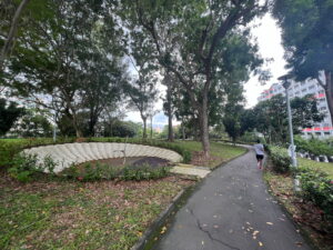
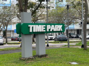
The final park I visited had the rather grandiose name, “Time Park”. I wasn’t able to find any information on it beyond the fact that it was opened in December 1994, and has a sundial as its focus. The implication seems to be that this sundial signifies time, hence the name of the park. All the same, they could have called it “Sundial Park” or something. “Time Park” sounds oddly abstract, like this is a place you would visit to contemplate eternity, or maybe a place situated within a mysterious temporal anomaly, where time itself stands still.
Tampines Park Connector and Pasir Ris Town Park
I won’t write very much about either of these places as I’m planning to do so later when I do a proper walk of Pasir Ris.
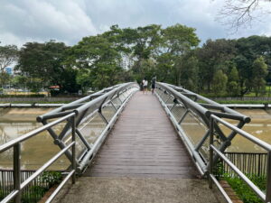
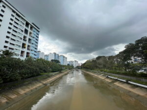
I encountered Tampines Park Connector just one time this walk, crossing the bridge over Sungei Tampines into Pasir Ris Town Park. I’ve been on this park connector several times before, including during my Tampines Geocaching walk, when I visited Sun Plaza Park. The park connector runs all the way to Simei MRT station, where it turns into Simei Park Connector, then Bedok Park Connector near Tanah Merah MRT, eventually taking you all the way to East Coast Park! I’ve walked or cycled this route several times, and might repeat it one day for this blog.
As for Pasir Ris Town Park, I neglected to take even a single picture of it, as by this time I was tired, and I’d been to this park multiple times before. Like I said, I’ll save it for another walk in Pasir Ris.
Rounding things off
All in all, I remember this to be a really varied walk, taking me from a light industrial estate to a private housing estate to an HDB estate, with a detour through one of Singapore’s more ulu locales along the way.
I imagine not everyone would enjoy walking through an industrial estate. It’s possible to plan an alternative route taking Old Tampines Road to Upper Changi Road North, avoiding it. For me, though, I thought it helped to round out a picture of Loyang, and as far as industrial estates go, it was far from the most unpleasant pedestrian experiences.
Walk details
- Date: Monday, 5 December 2022
- Distance: 11.26
- Time Taken: 2 hours 5 minutes
- Accessibility: As I did this walk quite a while ago I confess I don’t recall very much that would inform an assessment of how accessible it might be. Sections of Loyang Way were undergoing upgrading works at the time, requiring pedestrians to detour onto plywood boards laid over grass, which would have been a significant obstacle to those with limited mobility. Although these works surely would be done by now, it would not surprise me if construction work on Loyang Avenue had similar impact. As usual with private housing estates, I often found it necessary to walk on the road. The same is true of Abingdon Road and Cosford Road, although these were quiet enough I never had to worry about traffic. I took shortcuts across multiple void decks. Those with limited mobility should find this part of the walk doable, but may have to take a longer route using designated walkways.
Leave a Reply