Something I enjoy doing other than going for long walks is geocaching. I’ve mentioned it at least twice, in a couple of other posts. Geocaching is an outdoor recreational activity played the world over, in which some participants hide containers, or “geocaches”, in publicly accessible places, and other participants look for them, with the help of hints and GPS coordinates. Sort of like a global treasure hunt, where the prize isn’t any treasure per se, but the joy of discovering a new place, the excitement of the hunt, and the satisfaction of the find, and leaving your name behind on a log sheet in the hidden cache.

Geocaching and walking go well together, because it’s easy while you’re out walking to check your geocaching app of choice to see if there are any caches hidden along your way, and go look for them. You can even plan your entire walk around hopping from cache to cache to cache, looking for them.’
This is more or less what happened a few weekends back, in July. I found myself with slightly more than the usual amount of spare time, and figured I’d take the opportunity to explore slightly further afield, in Tampines. I’d had a route planned, but on the way there on the MRT, I checked and noticed there were quite a large number of caches scattered across the new town. I decided to scrap my planned route and organise my walk around hunting for these caches instead.
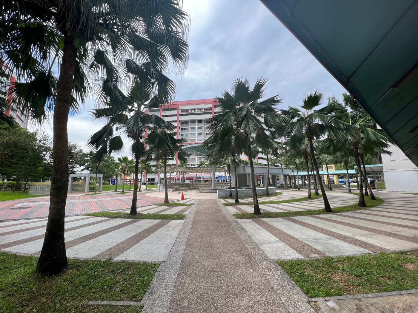
Tampines Central
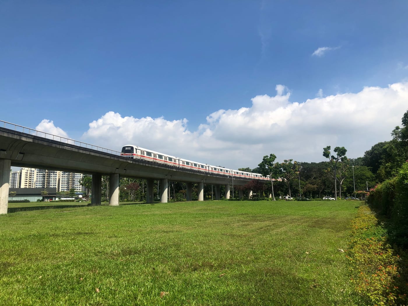
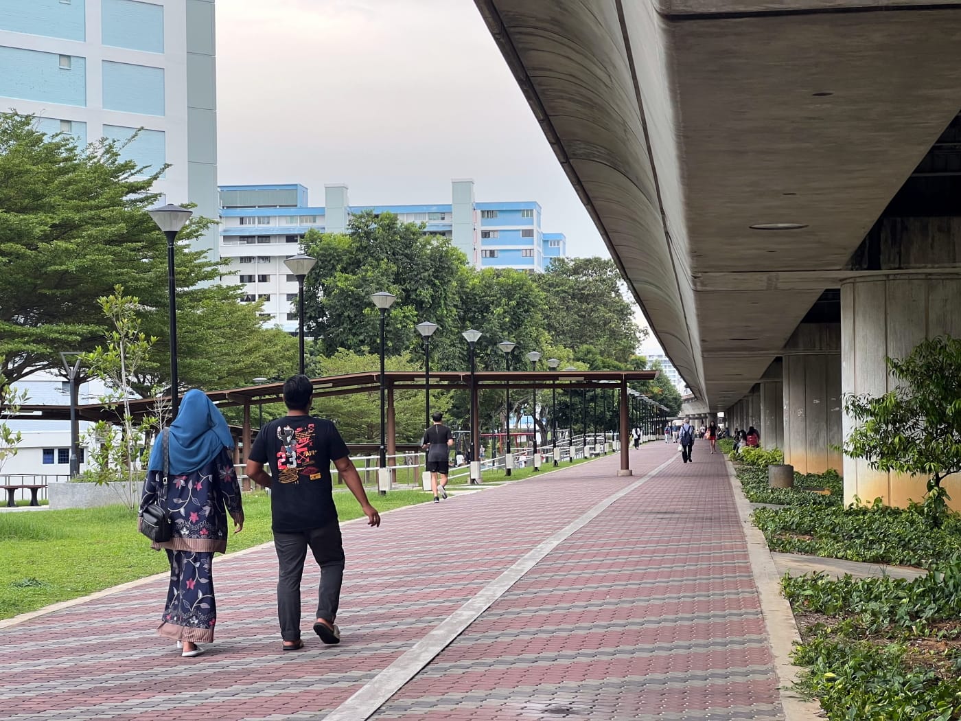
My walk began at Tampines MRT station, where I arrived on the Downtown Line. There weren’t any geocaches hidden in the immediate vicinity of the station, so I didn’t have any reason to linger. Instead, I followed the footpath heading north under the East-West Line MRT tracks towards the bus interchange and turned right onto Tampines Central 1.
How did Tampines get it’s name?
The history of Tampines goes quite a ways back. The first documented mention of a place in Singapore named “Tampines” can be found on Philip Jackson’s 1828 map of Singapore, which features a “R. Tampenus” in the northeast of the island, probably the same river we call the Sungei Tampines today.
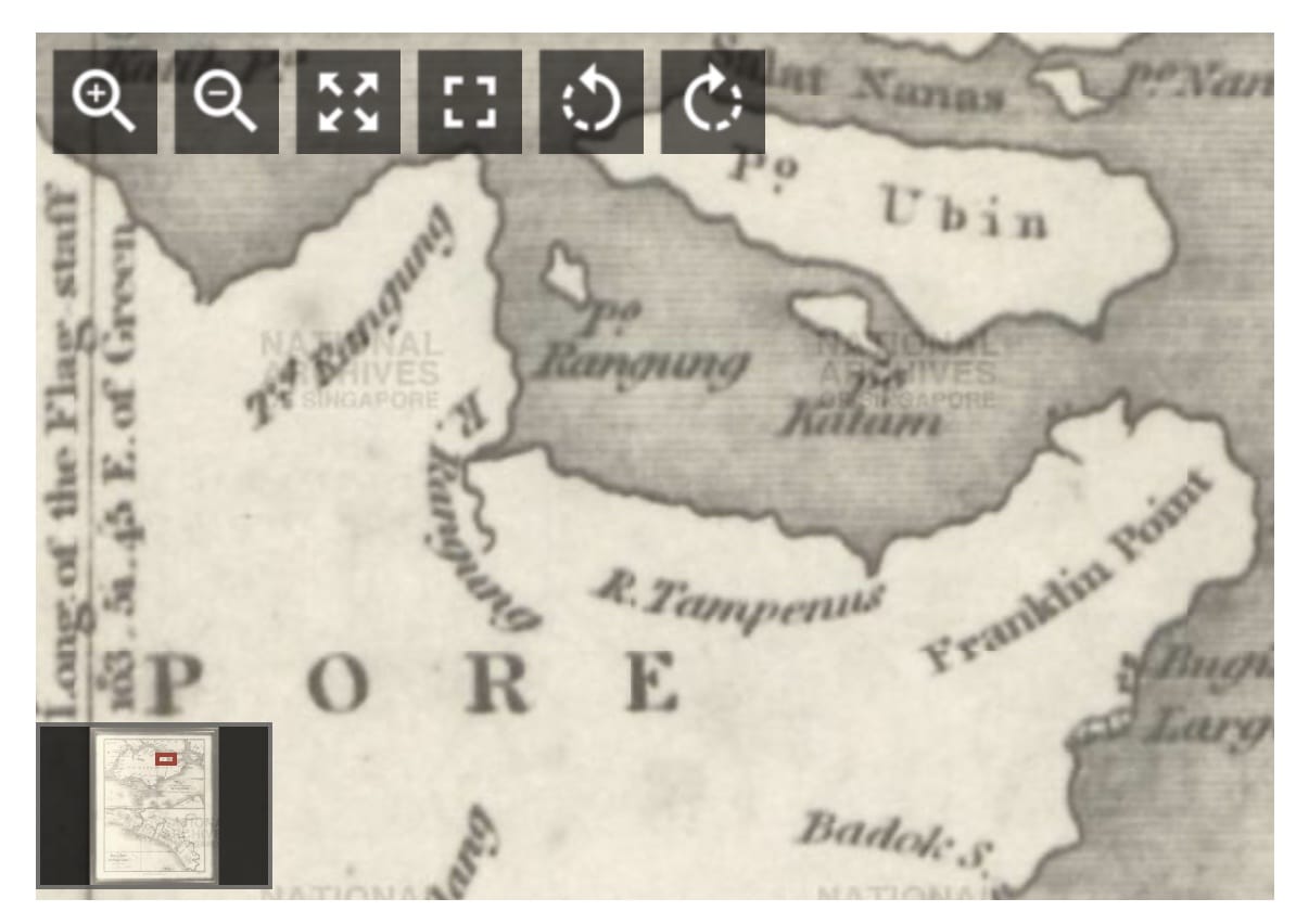
The first mention of a Tampines Road, on the other hand, can be found on this 1865 article, which mentions a “Tempinis Road” being widened to allow cart traffic. (The same article contains a sad story about prostitution and human trafficking in Singapore which is worth a read). The name Tampines ultimately derives from that of a tree, Sloetia elongata (Miq.) Koord., also known as the Tempinis or Tamping tree, which might have once grown in the area.
When we hear the name “Tampines”, though, most of us are probably thinking specifically of the new town, which is much younger. Plans for Tampines new town were only announced in 1979. That year, the HDB announced plans to spend S$835M on the development of six new towns in Singapore, including Tampines, as part of its 4th 5-year plan. The first flats in Tampines were ready to move into no later than 1983.
Tampines? Tampynes?
As you might have noticed, the name “Tampines” was not always spelt the way it is today. You might have thought that the spelling “Tampines” is a bit misleading. Perhaps you’ve heard foreign visitors pronounce it “Tam-pines”, or even jokingly pronounced it that way yourself.
Well, you’d perhaps be disappointed to learn this isn’t an original observation at all. Indeed, when “Tampines” was made the official spelling of “Tampines Road” all the way back in 1939, there was at least one indignant letter to the press arguing that the new spelling was “positively misleading”, suggesting the road might have something to do with pine trees instead, and being more intuitively pronounced “Tampynes”. The writer seemed to prefer the original spelling, “Tampenis”. I can sort of see why that spelling wasn’t kept, though…
Geocache no. 1: Sun Plaza Gardens
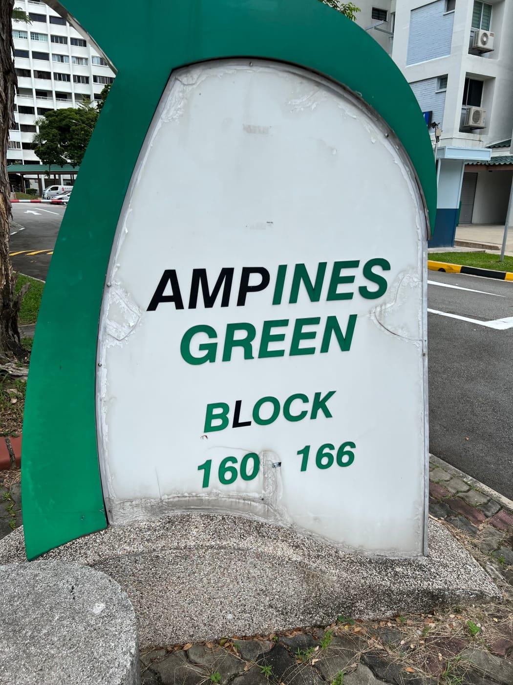
My first geocache of the day was located in Block 418 Tampines Street 41, within the Sun Plaza Gardens precinct, which is just as well, since this was a part of Tampines I’d never been to before, and I was happy for the opportunity to explore.
Most (but not all) geocaches come with a set of coordinates telling you where the cache is located this. This tends to be your first go-to source of information about the cache. Without it, you would have no idea where on Earth to even begin looking. It’s seldom enough, however. This particular cache, for example, is located more or less indoors, where x,y coordinates are not going to help. Instead, the cache’s description tells you to go to a certain lift lobby, take the lift up a certain level, and look for a certain thing.
I headed up Tampines Central 3, turned the corner around the former Tampines Regional Library building, and headed down Tampines Avenue 7, before crossing the street and turning again up Tampines Street 41. I arrived at Block 418 eager to log my first find. It didn’t take very long! I’m not going to spoil anything. If you’re keen, you should give it a try yourself! I logged my find on my geocaching app and headed back down to continue my walk.
Sun Plaza Park
The next geocache was located at Sun Plaza Park, which I’d visited twice being, although only passing through. I crossed Street 41 and headed westward under the HDB void decks towards the park. I wasn’t able to establish exactly when the park opened, but the first mention of it I was able to find in the press was in November 1995. It seems a whole slew of parks in Tampines were announced in 1992 and opened in 1995, so it’s quite possible Sun Plaza Park was one of them.
The 1995 article identified Sun Plaza Park as being one of four parks in Singapore designed by private sector consultants as part of a scheme to build up a pool of park design talent in Singapore. The other three parks identified were Istana Park, Mt Faber, and Labrador Park, so Sun Plaza Park was in good company!
Sun Plaza where?
I puzzled for a while about how the park got its name, considering the only other Sun Plaza I’d heard of was a shopping mall all the way over in Sembawang.
Turns out the park was originally called simply “Tampines Park”, but subsequently came to be called after an amphitheater in the park called Sun Plaza. Not only the park, but my walk here from Tampines Central had took me through two HDB neighbourhood precincts, Sun Plaza Garden and Sun Plaza View, both apparently named after this amphitheatre. Not to dump on Sun Plaza or anything – it looks like a decent enough place – but it does seem like quite an arbitrary landmark to name a couple of residential precincts after, and quite a minor and forgettable one at that. I didn’t even think to take picture during my visit!
Unfortunately the geocache I was going after turned out to be in a section of the park closed off for drainage works. I could possibly have snuck under the barriers, but there were workers about, and I didn’t fancy getting in trouble. So I gave up. It happens. I guess now I have an excuse to visit the place again. Another excuse: apparently, there are tempenis trees actually planted in the park! I had no idea! This is what happens when you do your research on a place after you’ve visited and not before.

Tampines Park Connector & Tampines North Primary School
The next geocache on my checklist was some distance away, on Tampines Street 43. I made my way out of Sun Plaza Park crossing over the Tampines Park Connector. The Park Connector runs north-to-south here. Northward lies Tampines Eco Green, and the Sungei Tampines canal, which only last year had been naturalised to return it, partly, to its riverine roots. Southward, the Park Connector continues all the way past Tampines Central towards Bedok Reservoir, as part of the Eastern Coastal Loop.
On this occasion, however, I followed a slightly more mundane route, walking under HDB void decks for a time before turning and following Tampines Avenue 9 eastward towards Street 43. About half way there, I passed by Tampines North Primary School. Schools in HDB estates are commonplace today, but Tampines is actually one of three new towns in Singapore to be the first with schools built at the same time as HDB flats, the other two being Hougang and Yishun. This was perhaps part of a turn in the 1980s towards an increasing emphasis on social aspects of estate management. Tampines North Primary School was not one of these schools build alongside HDB flats, though. It’s website says it opened in 1994.
Yishun: Not the only weird neighbourhood 🤨🤨🤨
Speaking of Yishun, while researching this blog post, I found quite a few newspaper articles seemingly putting to rest the idea that Yishun is the only neighbourhood in Singapore where weird things happen.
In 1951, for example, a skeleton was found buried in a swamp, which turned out to be a member of the Malayan Communist Party. The skeleton was recovered by Special Branch officers, who walked a mile through the swamp to get to where it was buried, and then dug for 20 minutes before finding it. So, they must have known it was already there??????? 😨😨😨
A few years later, in 1956, an army truck broke down. While soldiers helped to get the truck going again, one of them happened to put his gun down, only realising he had done this after the truck got going again and had left! The truck returned to the scene, but found the gun missing, sparking off a 5-hour hunt before the weapon was finally recovered. 🔫
The very next year, a young man was stabbed to death in a gang fight, along with two others. So far this is a sad story, but hardly weird. However the newspaper, The Straits Times, by the way, and not a tabloid, starts going on about how the guy was a “dandy”, who loved wearing fancy clothes🕺🏻🕺🏻🕺🏻. Two whole paragraphs are dedicated to describing how before leaving home that night, he combed his hair and put on a white shirt and well-pressed grey trousers. Why the fixation on this aspect of the victim’s character???
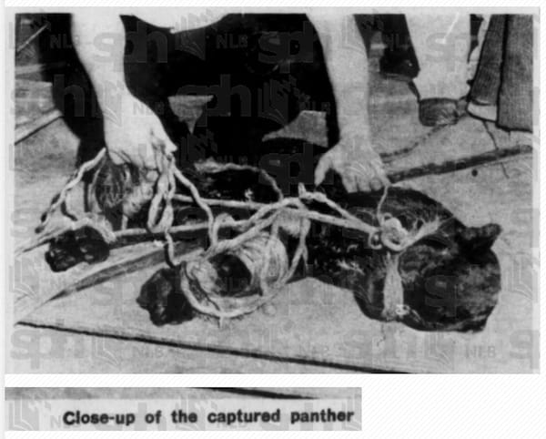
Jump ahead to 1974. A villager spotted “an animal resembling a lion” and called 999🦁🦁🦁. Armed police and soldiers searched for 14 hours, through the night and early morning, before calling off the hunt, as no trace of the alleged animal was found. Could the villager have been imagining things? Perhaps… Just a year later, though, a real big cat was caught, albeit not a lion but a panther🐈⬛🐈⬛🐈⬛. This time, the last hunted 24 days. The animal was apparently smuggled into Singapore, but then escaped, and terrorised villagers (and their fowl) in Tampines until it was eventually spotted and caught in a fuel tank in a Tanjong Rhu shipyard. A coincidence???? Who knows…😨😨😨
Granted all of the above happened mainly around Tampines Road, which runs a fair distance and includes parts of Singapore we don’t tend to think of as Tampines today, but still… 🤨🤨🤨
Geocache no. 2: Tampines Street 43
The next geocache, named “Fridgin’ Cool”, was apparently hidden somewhere around a trio of community fridges at Block 441 Tampines Street 43. Two fridges were left at the void deck of this block back in 2017 and stocked with donated food, to benefit low-income families living in rental flats the neighbourhood. A third must have been added at some point after.
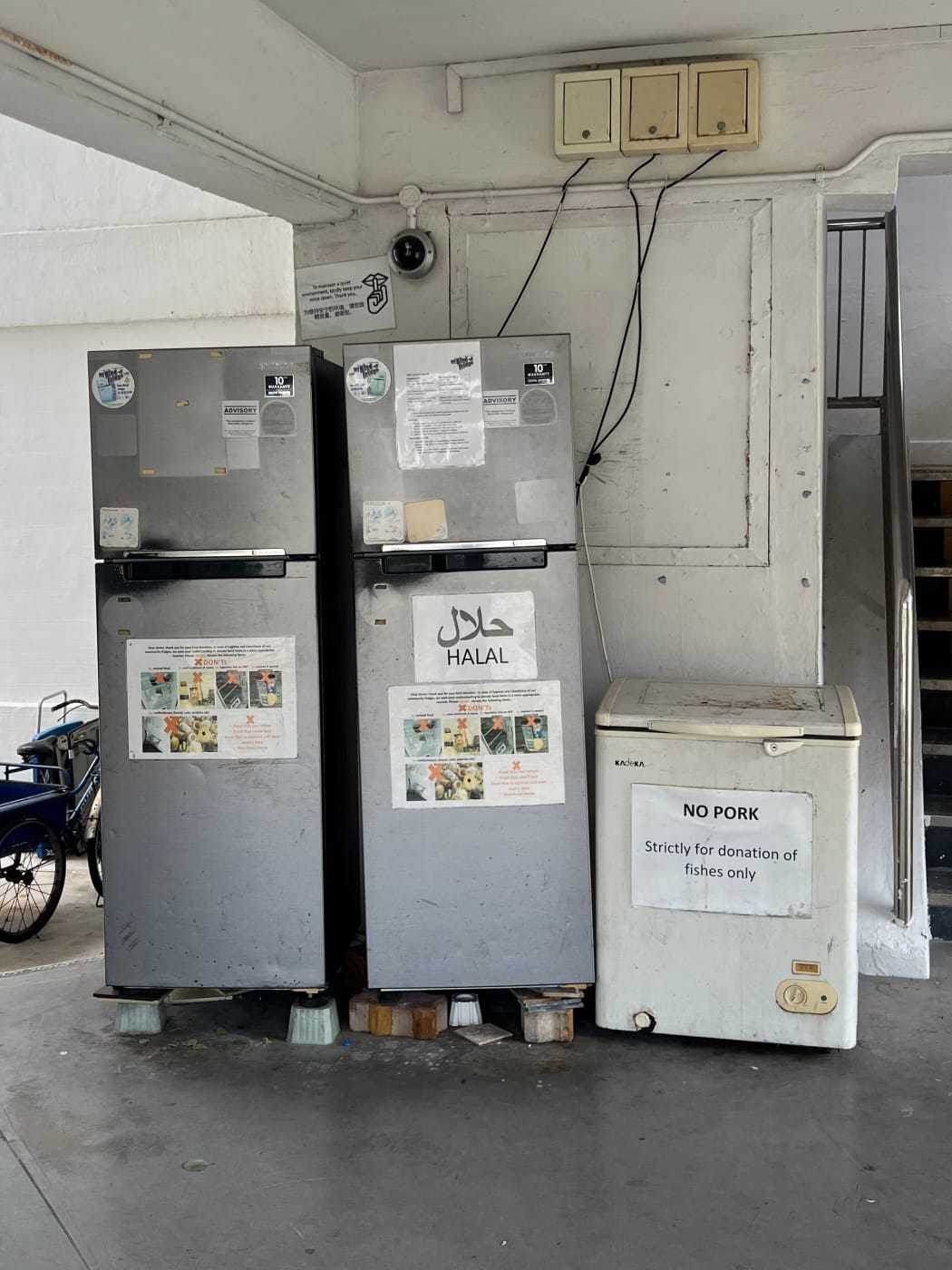
Today, this fridge, along with several other community fridges across the island, are apparently being restocked by a group of volunteers calling themselves Fridge Restock Community Singapore. Be sure to check on their website!

The cache itself was not hard to find. In fact I found it more or less immediately. After you’ve been geocaching for a while, you tend to develop an instinct for where caches tend to be hidden, and 80% of the time, they’re more or less exactly where you expect them to be.
Tampines Neighbourhood 4
After logging the cache I headed back up Street 43 and continued eastward along Avenue 9. It didn’t take long for me to arrive at a decently sized public square, with a gate leading into it from the main road identifying the square as “N4 Neighbourhood Centre“. If I thought the names “Sun Plaza Garden” and “Sun Plaza View” were slightly underwhelming, whoever named “N4 Neighbourhood” evidently made no effort at all!

This perhaps isn’t entirely fair. The neighbourhoods of Tampines new town were pioneering in their time, for having been designed around precincts. Tampines would have nine neighbourhoods (N4 presumably being one of them), each having seven precincts, and each precinct in turn having a focal point in the form of a playground, landscaped park, or some other recreational area, lending it a distinct identity. This was all part of a policy to provide better housing to Singaporeans, to adapt to rising standards of living and meet the needs of higher incomer earners.
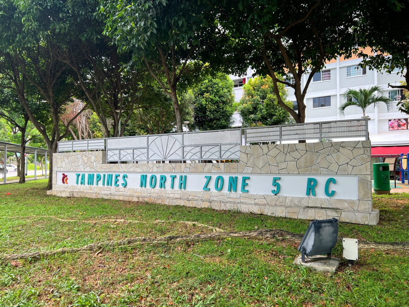
Neighbourhood 4 itself is unique in being the first HDB estate in Singapore with flats designed by private architects. A decade into the development of Tampines new town, the HDB launched its “Design-and-Build” scheme, awarding contracts to design and build HDB blocks in N4 to private sector firms. The aim was not only to inject greater variety into the design of HDB estates, but also to provide HDB with the opportunity to learn from the private sector.
Former Tampines Junior College
I followed Tampines Avenue 9 as it curved south, eventually hitting Tampines Avenue 7 and turning eastward down it, heading towards the location of the next cache. Along the way, I passed by the buildings which made up the former Tampines Junior College (TPJC).
TPJC arrived in Tampines shortly after the new town itself was built, accepting its pioneer cohort of 698 students and 33 teachers on 11 April 1986, although it only moved into its building here on the corner of Avenues 7 and 9 later that year, on 20 December.
In 2017, the Ministry of Educated announced the merger of several JCs, including TPJC, in response to a steady decline in the number of students entering JC, more or less the opposite of the trend which spurred the creation of TPJC in the 1980s in the first place. TPJC would merge with another school, Meridian Junior College (MJC), to form Tampines Meridian Junior College (TMJC). This began operations at MJC’s site in Pasir Ris in 2019.

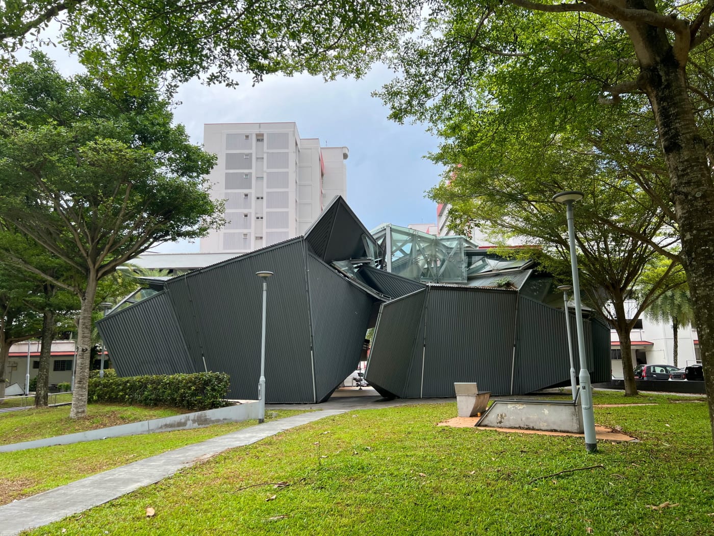
The old TPJC building apparently won the Best Designed College Building Award in 1988, a somewhat strange award, considering there are only so few colleges in Singapore eligible for it in the first place? I do find the building’s use of geometric shapes rather pleasing. TMJC’s more modern building strikes me as rather characterless.
Geocache no. 3: Tampines Street 24
I ended up failing to find the next geocache as well, although just like the cache at Sun Plaza Park, it wasn’t for want of searching. This cache was apparently hidden somewhere on or around a playground swing, somewhere between Blocks 372 and 374 Tampines Street 34. A young couple and their kids were riding the swing when I visited, making it impossible to search for it.

In geocaching parlance, members of the non-geocaching public are called “muggles“, borrowing from the Harry Potter franchise. You have to be careful about letting muggles see you looking for a cache, in case it arouses suspicion, and/or leads to the cache being removed, or “muggled”. I could have waited for these particular muggles to leave, but I decided not to. Who knew how long that would have taken? I could always come back.
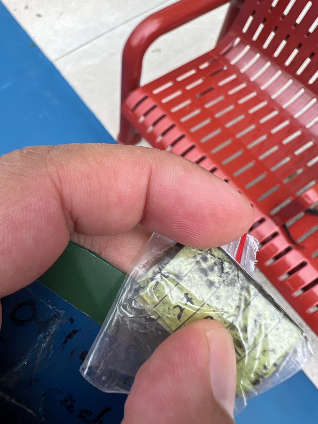

I instead headed back west, walking under HDB blocks and crossing Tampines Avenue 2 and heading towards the next cache in my list. This one was apparently hidden on some exercise equipment in an outdoor fitness corner near Block 230 Tampines Street 24. Finding this one turned out to be pretty easy, especially with the hint provided by the cache owner (CO) on the geocaching app. The tricky bit was extracting it, as it was hidden in a pretty tight spot. That took a bit of creativity and a whole lot of stealth. I logged my find, and was off.
Tampines Festival Park
Next up: Tampines Festival Park. There wasn’t a cache hidden in this park, but I was so taken by its appearance on my map – a circle of green sitting at the centre of a cluster of HDB blocks surrounded by a ring road, like the nucleus of a giant amoeba – that I had to visit. It wasn’t very far. I headed south down Tampines Street 24 and briefly followed Street 21 clockwise around the HDB blocks before turning in at Block 263 Tampines Street 21, and walking to the park under the void decks.
The development of Tampines Festival Park was announced in 1992, as part of a $20 million project to make Tampines a “Community Living in a Garden”. This was seemingly in conjunction with Tampines winning a “United Nations World Habitat Award” as an example of “an innovative and successful human settlement”. The park was opened in 1995 by the Minister for Communications Mr Mah Bow Tan, who was also an MP for Tampines GRC.
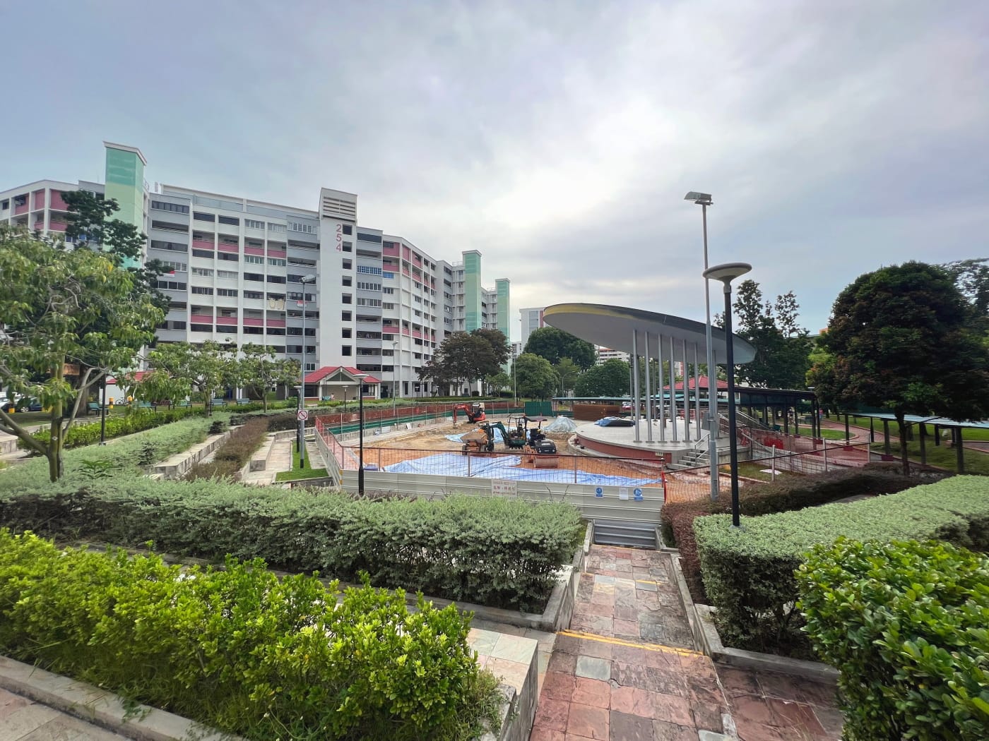
Perhaps fittingly, the amphitheatre at the centre of the park was undergoing some renovation when I visited. I managed to find a photo of the amphitheatre in 2016 looking much the same as it does today, so perhaps only the ground around it was being improved.
Several other parks were also announced as part of the “Community Living in a Garden” project, all apparently designed a single theme. There was “Youth Park at Tampines Avenue 5”, which was designed with children in mind, given the nearby schools, Garden Community Park catering especially to older residents, Tampines Woods retaining its pre-existing wooded ambience, and Tampines Memorial Park having a cluster of Tampines trees.
This is just speculation, but I wonder if Tampines Memorial Park may ended up being renamed Sun Plaza Park, since that was also opened in 1995, and apparently has Tampines trees in it as well. I certainly wasn’t able to find any park named Tampines Memorial Park today.
Geocaches no. 4-7: Tampines Avenue 2
The Little Free Library
The next four caches were a bit of a blur, being located fairly close to each other. The first of the four was located not far away from Festival Park, under Block 267 Tampines Street 21, a registered Little Free Library.
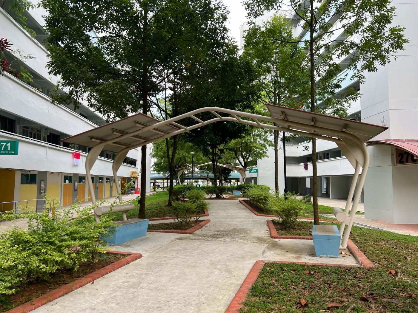
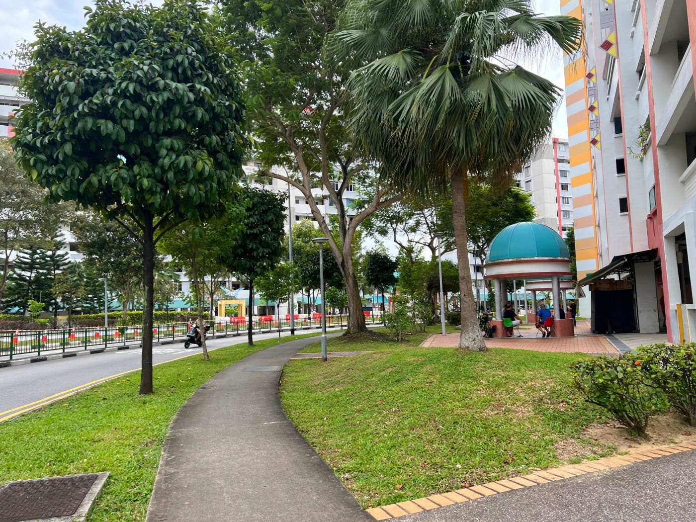
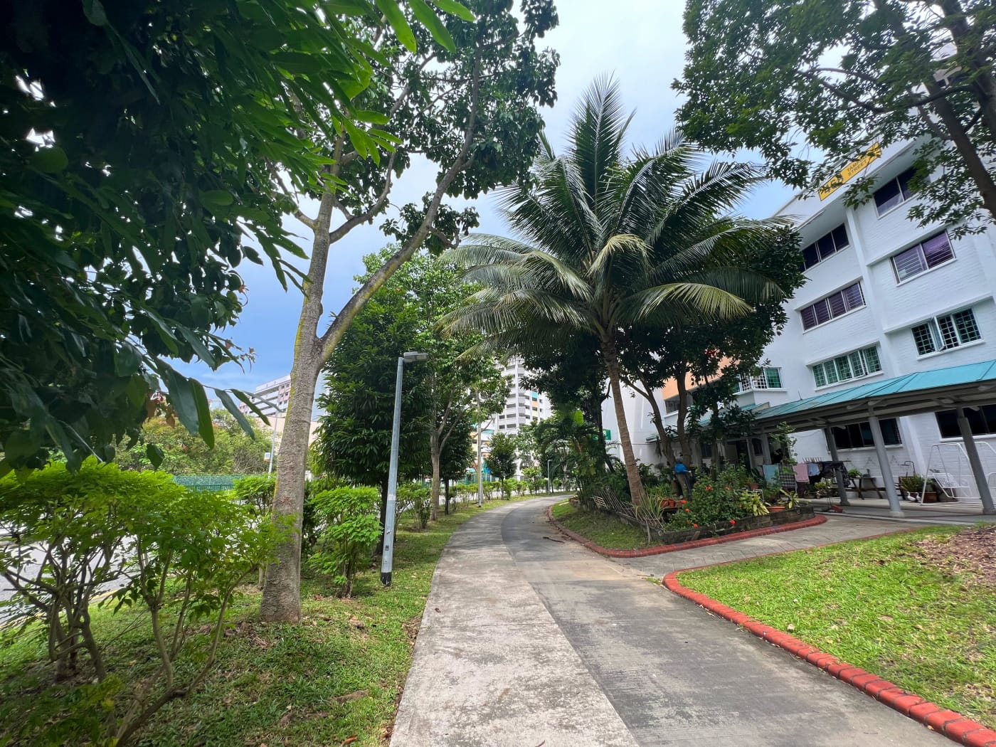
I arrived at the library walking along a windy footpath running between Blocks 267 and 269, with really interesting sheltered benches, arranged in pairs with a shelter extended up and over between them. Neighbourhood park furniture fascinates me a little bit, because I always wonder who designs and manufactures them. Are they designed and built for purpose? It sometimes feels like they must be, because they’re so unique and lend their parks such character. And yet, wouldn’t that make them expensive? I imagine there must be a catalogue of these somewhere. I would love to have a browse of one.
Anyway, I won’t spoil the location of the geocache, but this one was fun. Maybe a bit obvious, but clever and appropriate in its own way.
Church of the Holy Trinity
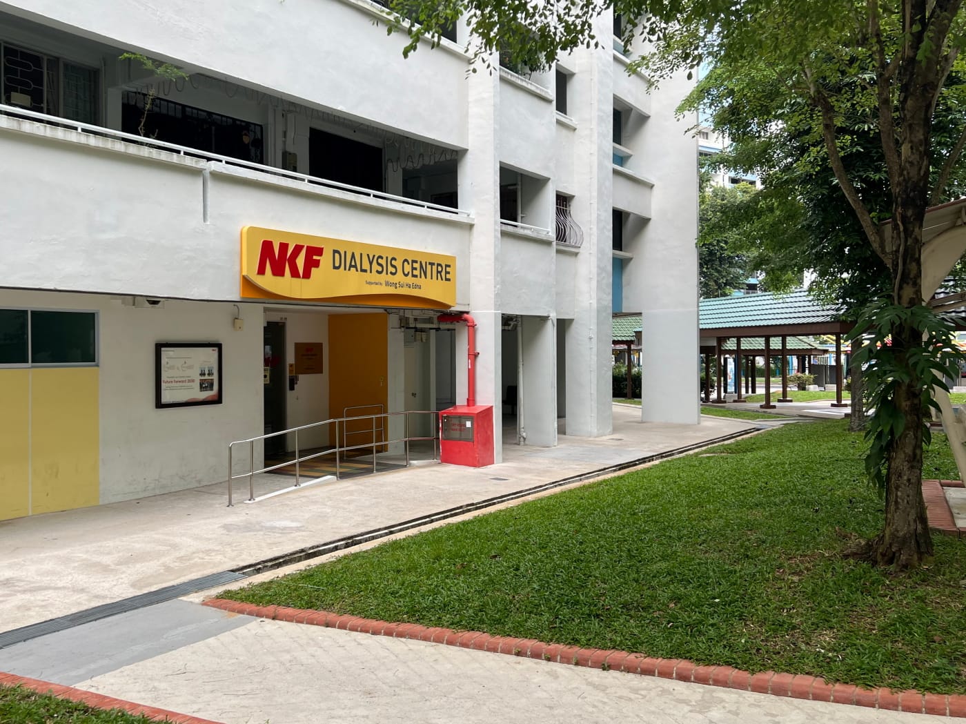
I continued my way down the footpath towards, Avenue 2, passing by the Wong Sui Ha Edna NKF Dialysis Centre.
The next cache was named after the Church of the Holy Trinity, just across the street. It wasn’t located in the church, though, but rather nearby, under a pedestrian bridge. I think this is fair enough. The geocaching guidelines on geocache locations don’t say anything specific against hiding caches in places of worship, but it’s prudent to be respectful, and to an extent I think it’s each community member’s call what respectful means.
I’d found caches hidden under pedestrian bridges before, so this one wasn’t too hard to locate. I found it, logged it, and was off.
The Avenged DNF
When you fail to find a geocache, you log what the community calls a Did Not Find, or a DNF. You do this not only to keep track of caches you’d found and haven’t found, but because a series of successful DNFs might prompt the cache’s owner that the cache might genuinely have gone missing, or been “muggled” – removed by a muggle. If you previously DNFed a cache, and then later went back to try again, and this time found it, then you’ve avenged your DNF!

The next cache was just such a cache for me. I’d come looking for this cache at some point a year or more ago, and failed to find it, despite coming with another geocacher, who helped search. It’s possible the cache had been muggled then, because this time I found the cache instantly. I’m pretty sure I searched the same place back then too.
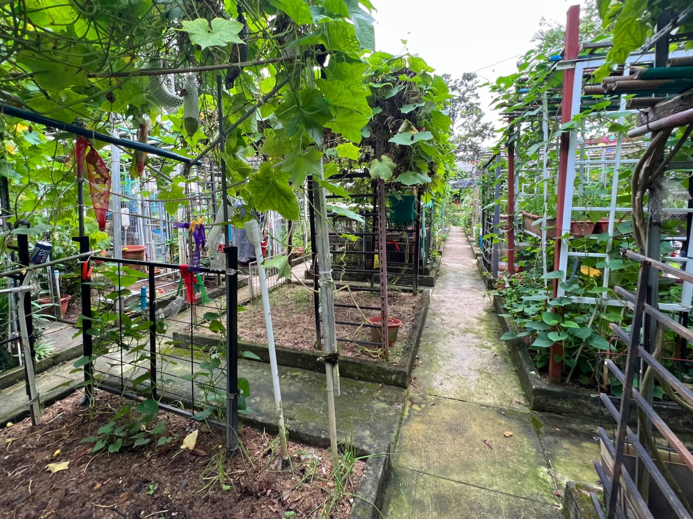
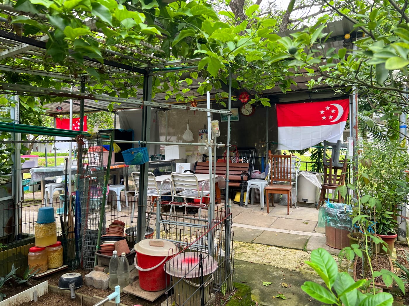
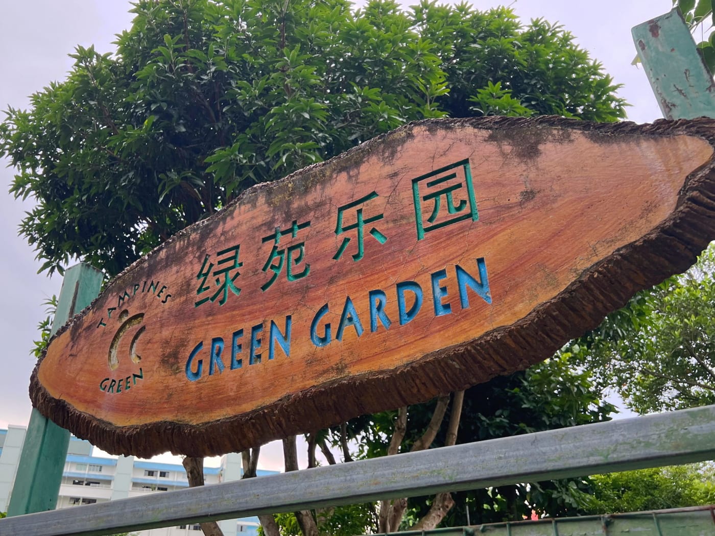
Tampines Green Community Planting Garden
The last of the four caches was located in Tampines Green Community Planting Garden. I crossed Tampines Avenue 2 and followed it westward towards the MRT tracks, briefly returning to Tampines Park Connect as it ran between Tampines and Simei MRT stations. I found the garden full of children playing, which is always great, even if it does often make it hard to look for caches without being spotted.
This cache, however, turned out to be hidden in a quieter spot. It took me a while to find, because, IMHO, the hint given by the cache’s owner was a little misleading. But I got it in the end, and then I was off, towards what I expected would be my final three caches.
Tampines Street 11
I ended up not even bothering to even look for two of the remaining three caches I’d had my eye on for the day. The first was hidden under another pedestrian bridge, near the junction of Avenue 2 and Street 11. Previous logs suggested this cache was rather dirty. There were days I would not hesitate to go looking for it anyway, but this day I just wasn’t in the mood.
The second was down Street 11, hidden somewhere on a bus stop. I headed down Street 11, which I’d actually walked before not long ago, heading in the direction of Tampines Changkat Community Club, but stopping just before and crossing the street to the bus stop outside the new Treasures at Tampines condominium, still under construction.
This one really should have been an easy find. However, there was a lady waiting at the bus stop, and I could tell I was making her a little nervous loitering around eyeing the bus stop up and down. Last thing I wanted to do was make someone feel uncomfortable. I could have gone somewhere else and come back again when she’d boarded her bus, but I was running short on time, so I gave up. Another excuse to visit.
Tampines Round
So there was just one cache left: just outside SAFRA Tampines. To get there I headed down Tampines Lane, a street so new it doesn’t yet exist on OpenStreetMaps, and Google Maps doesn’t yet have StreetView data for it. At least not at time of writing.
Reaching Tampines Avenue 5, I turned right and headed northwest before crossing it with the help of a pedestrian bridge. From the bridge, I caught a glimpse of the Tampines Round Market and Food Centre which gives the neighbourhood I’d just passed by its name. Aside from its unique round shape, the market was apparently the first in Singapore with a wireless hotspot.

Tampines seems to have been home to many firsts. The first neighbourhood with schools built at the same time as HDB flats… The first with HDB flats designed by private architects… HDB blocks and flats also incorporated new design features meant to improve their aesthetic quality, such as ceramic tile floors, arched canopies on common corridors, camouflaged water tanks, and varying building heights. Tampines even pioneered the painting of block numbers of the sides of HDB blocks, a feature we recognise throughout Singapore today!
One major first was the introduction of prefabrication as a way to speed up construction and bring down costs. Articles appeared in the press extolling the qualities of prefab construction with fancy graphics, explaining how prefab construction was done using step-by-step diagrams, and reassuring the public that prefab flats were just as strong as regular ones. The first 9 prefab HDB blocks were completed and made available for balloting in 1983.
Prefab construction ultimately became the norm in Singapore, with HDB developing its own Precast Building System and 33% of units launched in 2019 constructed using Prefabricated Prefinished Volumetric Construction (PPVC), a form of prefab construction in which entire rooms are prefabricated offsite.
Geocache no. 8: SAFRA Tampines
I won’t bore you with an unnecessarily detailed description of the rest of the walk. After crossing Tampines Avenue 5, I made my way around the grounds of SAFRA Tampines to its entrance on Tampines Street 32, where the final cache was hidden. This I found without too much difficulty after a bit of poking around.
I ended my walk at Tampines West MRT station, just a shot hop away, on Tampines Avenue 1. It was on the whole a pretty relaxing walk, with lots of diversions to go looking for geocaches. Tampines itself is a fine estate, and one of my favourites in Singapore to explore. I’ll definitely be back, in search of those caches I failed to find, as well as those which I’d decided were a bit too far afield for this particular occasion.
Walk details
- Date: Sunday, 23 July 2023
- Distance: 10.19km
- Time Taken: 2 hour 34 minutes
- Accessibility: Multiple segments along this route may be inaccessible. However, none are so bad as to render the route unfeasible. I have tried my best to mark out problematic areas and propose alternative routes in the map below. In particular, not all geocaches are accessible. Geocachers who hide caches are encouraged to mark their cache as “accessible” whenever this is the case. This attribute is visible when viewing the cache on the official geocaching website and app, as well as in most reputable third party apps, including the one I use: Cachely. Caches given a terrain rating of 1 star are required to be wheelchair accessible.
Leave a Reply