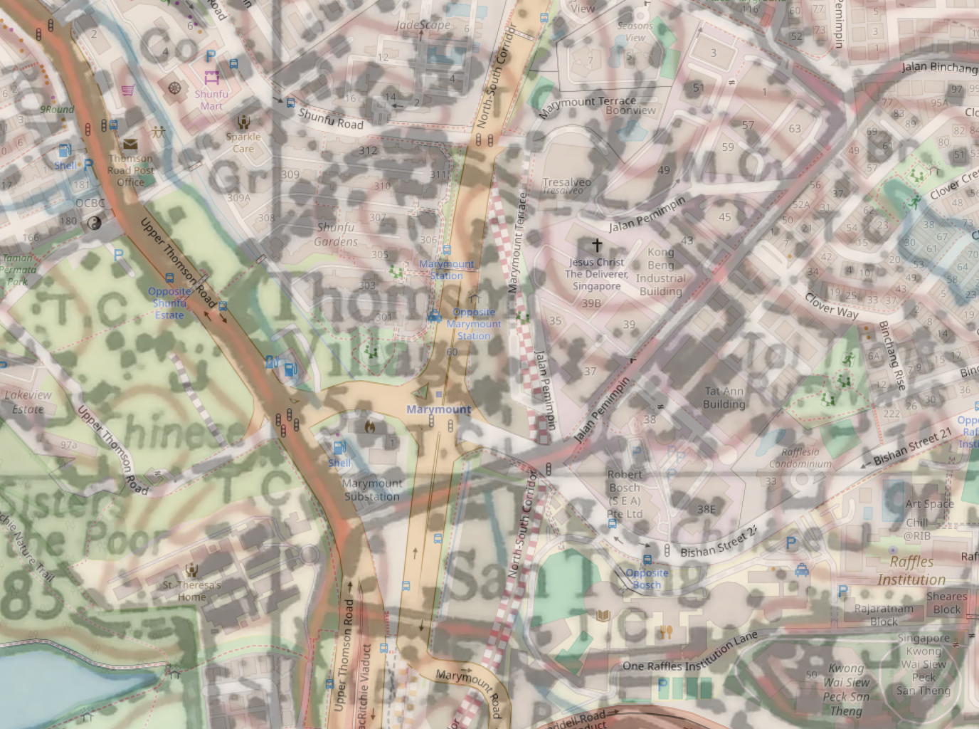
So back in August I decided to go for a quick walk one Sunday afternoon, somewhere not too far from where I lived: Shunfu, Jalan Pemimpin, perhaps as far as Bishan.
The year so far hasn’t been a great one for walks. I’ve gone for walks far less frequently, and the walks I’ve been on have been shorter, or not so interesting. A large part of the reason is I’ve developed some other hobbies that have been taking up more of my spare time. But I enjoy walking still, and there are Sundays like this one, when I managed to snatch a couple of hours to go for a short one.
I started my walk at Upper Thomson MRT station on the Thomson-East Coast (TEL) MRT line, taking Exit 4 and heading southeastward along the shophouses lining the road. This section of Upper Thomson is apparently known for its vibrant food and cafe culture, I’m a bit of a homebody, and never really availed myself of any of this culture, despite not living far away. But it’s nice that it’s there for sure.
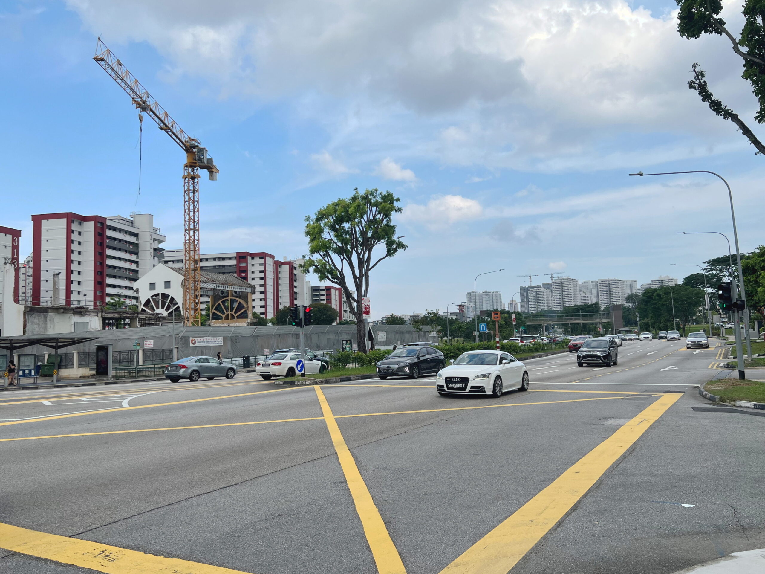
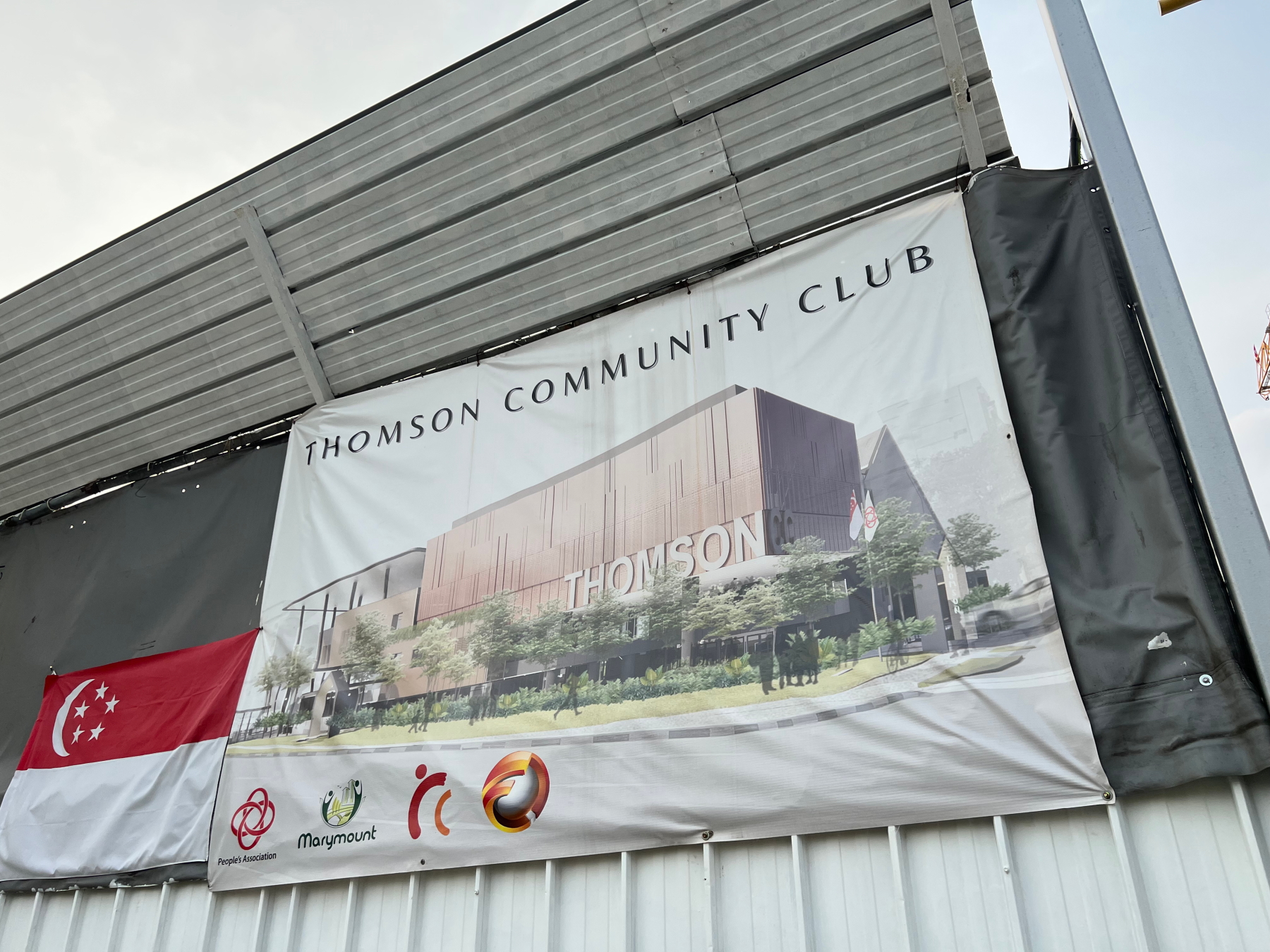
Arriving at Jalan Pelatina, I crossed Upper Thomson Road and made my way around Thomson Community Club.
Thomson Community Club
Thomson CC was one of those local landmarks that had always just been there. When I was a kid my parents signed me up for classes there, including one art class I remember where we made clay animals. I might actually still have a clay elephant I made during that class, nearly several decades later!

I say “was” because the building is currently being renovated, and has been since April 2019. The work was supposed to be done in 2021, but work was interrupted by the COVID-19 pandemic. The contractor in charge apparently ran into financial trouble and wasn’t able to complete the job. The building has remained in a barely-begun state since then. It was only just announced in June this year that a new contractor had been hired, and the CC was set to reopen in 2025.
Thomson Road Community Centre and Thomson Village CC
I did a bit of research into the history of Thomson CC and was pleasantly surprised to learn that there had been several CCs bearing the name “Thomson”.
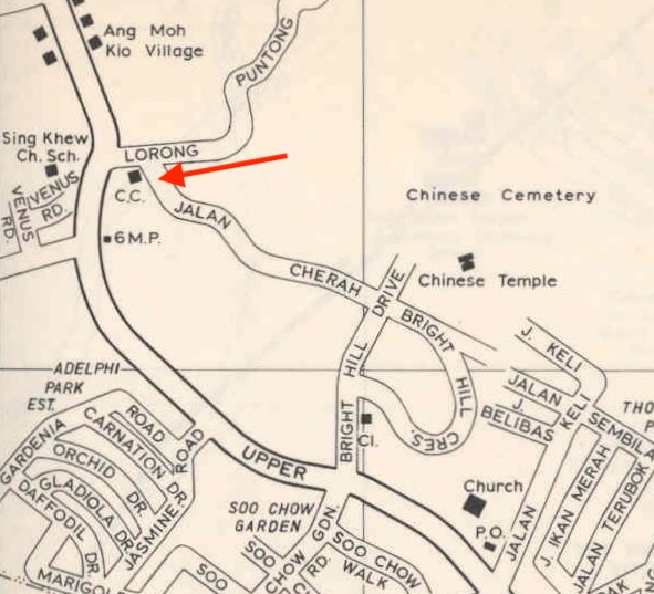
The first mention of a “Thomson CC” I could find was a 1972 newspaper article about a tennis championship taking place at Thomson Community Centre on 14 March of that year. This article, however, places the CC at the 6th mile marker, which is further up Upper Thomson Road than today’s CC. And indeed the 1972 edition of the Singapore Street Map (sheet 61) shows a CC close to where Upper Thomson Road meets Sin Ming Road today.
Prior to that, there had been a “Thomson Road Community Centre”, which I found a photo of taken in 1956, on the National Archives’ Archives Online portal. I wasn’t able to establish the location of this, and don’t want to assume it’s the same CC as the one above, since it’s named differently.
And finally, there was a “Thomson Village CC” supposedly located at the 6.5th mile marker along Upper Thomson Road. The 1972 Street Map (sheet 45) shows a CC somewhere between the 6th and 7th miles, along a road called Jalan Kukus which no longer exists today (closes extant road being Jalan Tambur). Could that have been it? Matches the description, anyway.
A new Thomson CC
A newspaper article from April 1982 reveals that funds were being raised that year for a new Thomson CC, presumably at the current site, and indeed in November that year it was announced that the new CC would be constructed next to what was then the Imperial Cinema (today the site of Thomson Imperial Court condominium), at a cost of $3M. A groundbreaking ceremony took place at the site in December 1982, and sure enough, the new Thomson CC was officially opened on 15 October 1984.
The CC apparently aimed to be a centre of excellence for arts and culture in Singapore, something I never knew or heard about, and in 1986 it won an architectural award for its “covered link staircase”, which I have to confess I hadn’t really noticed either. The building did, however, have a rather iconic multipurpose hall – iconic in the area anyway, which I see is being retained in the new design, although it will be somewhat sidelined, I think.
An interesting titbit might be that the CC used to be known as a “Community Centre”. I don’t know when it was renamed to “Community Club”, but the last mention I could find of “Centre” was in an April 1991 newspaper article, while the first mention of “Club” was just two months later in June 1991. I’m not sure what prompted the name change.
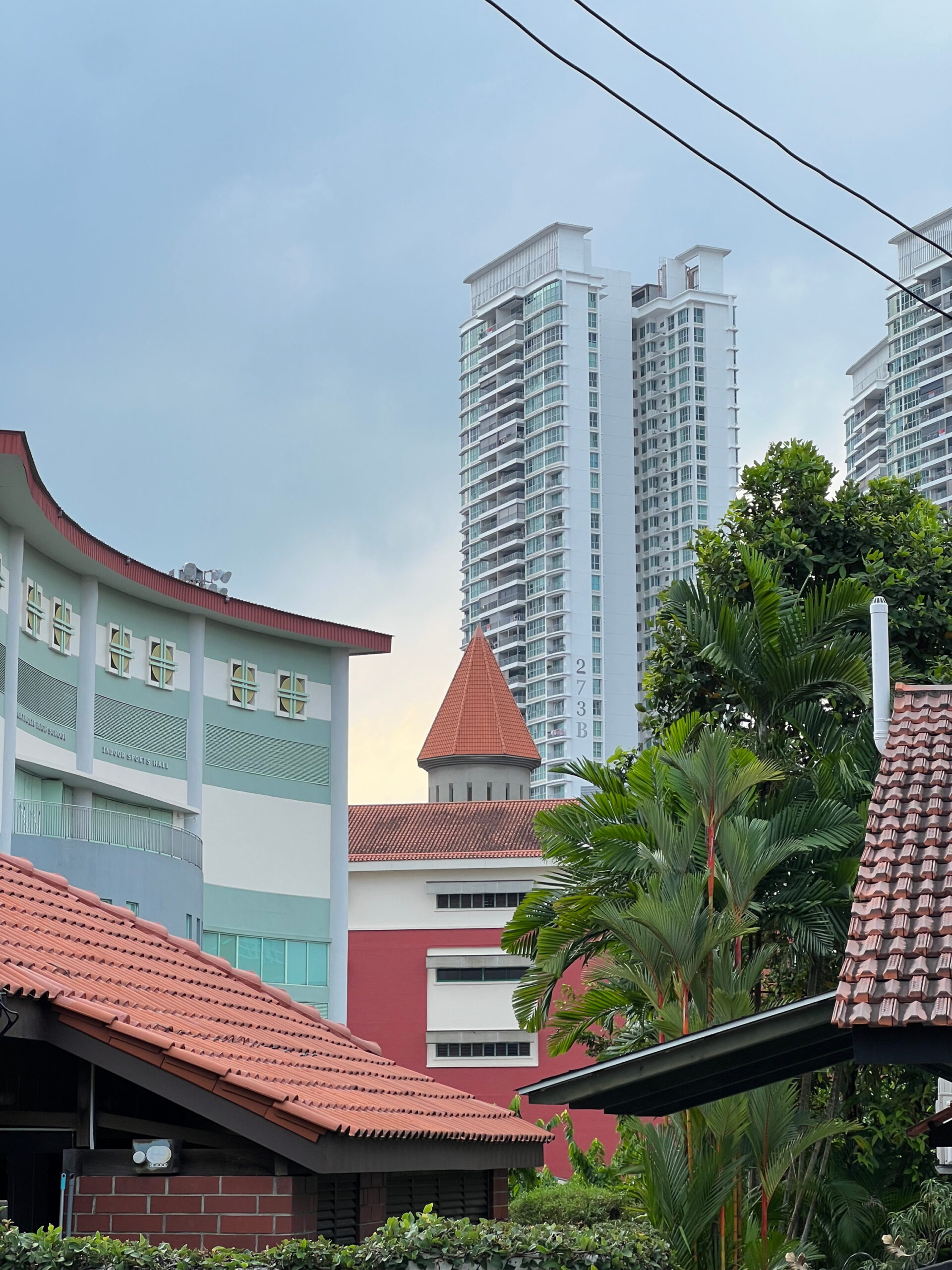
Shunfu Estate
Walking past the construction site that will one day soon be a reopened Thomson CC, I crossed the bridge over a canal and into Shunfu Estate. As a kid my parents sent me to a PAP-run nursery here, which seems to still be there, under the PCF Sparkletots brand. Surprisingly I have a few memories about coming here: stopping by a shop on the corner of Upper Thomson Road and Jalan Pelatina, where there’s a cafe now, to buy egg tarts from a shop that sold dim sum; doing my Chinese spelling exercises in colour pencils and colourful felt-tip pens and getting scolded by my teacher for not using pencils. I still take offence at the latter memory, because I personally think this poor teaching, scolding a child for being creative, and insisting on uniformity. My parents took me out of the school the year later for kindergarten. I doubt this would have been the reason, but if I’d been in the same position I would have done the same.

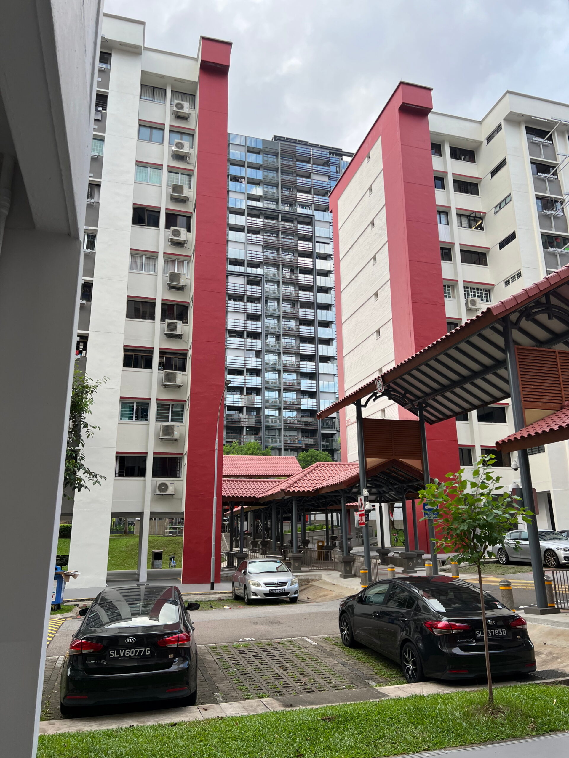

I’m not 100% sure when Shunfu estate was completed, but I reckon it must have been sometime towards the end of 1984 and the beginning of 1985. On the one hand, the 1984 edition of the Singapore Street Map (sheet 132) show the blocks making up the estate, already numbered. On the other a newspaper article from as late as 1 Dec 1984 talks about the estate in the future tense. In any case, it would have been no later than 1 April 1985, because on that date a resident wrote in to the Straits Times claiming to have recently moved in, complaining about a road there. A photo from November 1985 of then Minister of State for Defence and Trade and Industry Lee Hsien Loong standing across the street from Thomson CC shows Shunfu Estate in the background, looking much like it does today, with fewer amenities up front.

I wandered my way through the estate, not taking the shortest route but carving a rather convoluted one under the void decks. Nothing major seems to have happened in Shunfu Estate since its launch in the mid-1980s, which you could see as a good thing. I happened across just one article from 1995 about how the then-Television Corporation of Singapore (TCS), now MediaCorp, had been filming a scene for a programme under block 304, involving the burning wreck of a car. Apparently smoke and soot had gotten everywhere, even inside some residents’ flats. And TCS hadn’t done a very good job cleaning up after themselves either, leaving behind a blackened mess on the surface of the car park and nearby grassy verge that residents and the Town Council had to clear. Doesn’t strike me as particularly responsible.
People want interesting estate names?
Another interesting newspaper article I found called to mind something I wrote in a previous blog post, about boring neighbourhood names in Tampines. Apparently, this is hardly an original complaint. A newspaper columnist in 1990 wrote a slightly tongue-in-cheek article lamenting the state of neighbourhoods in Singapore, how boring they were, beginning with their boring names. “Few people,” he wrote, “like to hail from Block 123, ABC New Town, Neighbourhood 4, Avenue 5, Hex Number XX-6789, Singapore 1011.” He cited specifically cited Shunfu as a positive example of a neighbourhood with a distinct name.
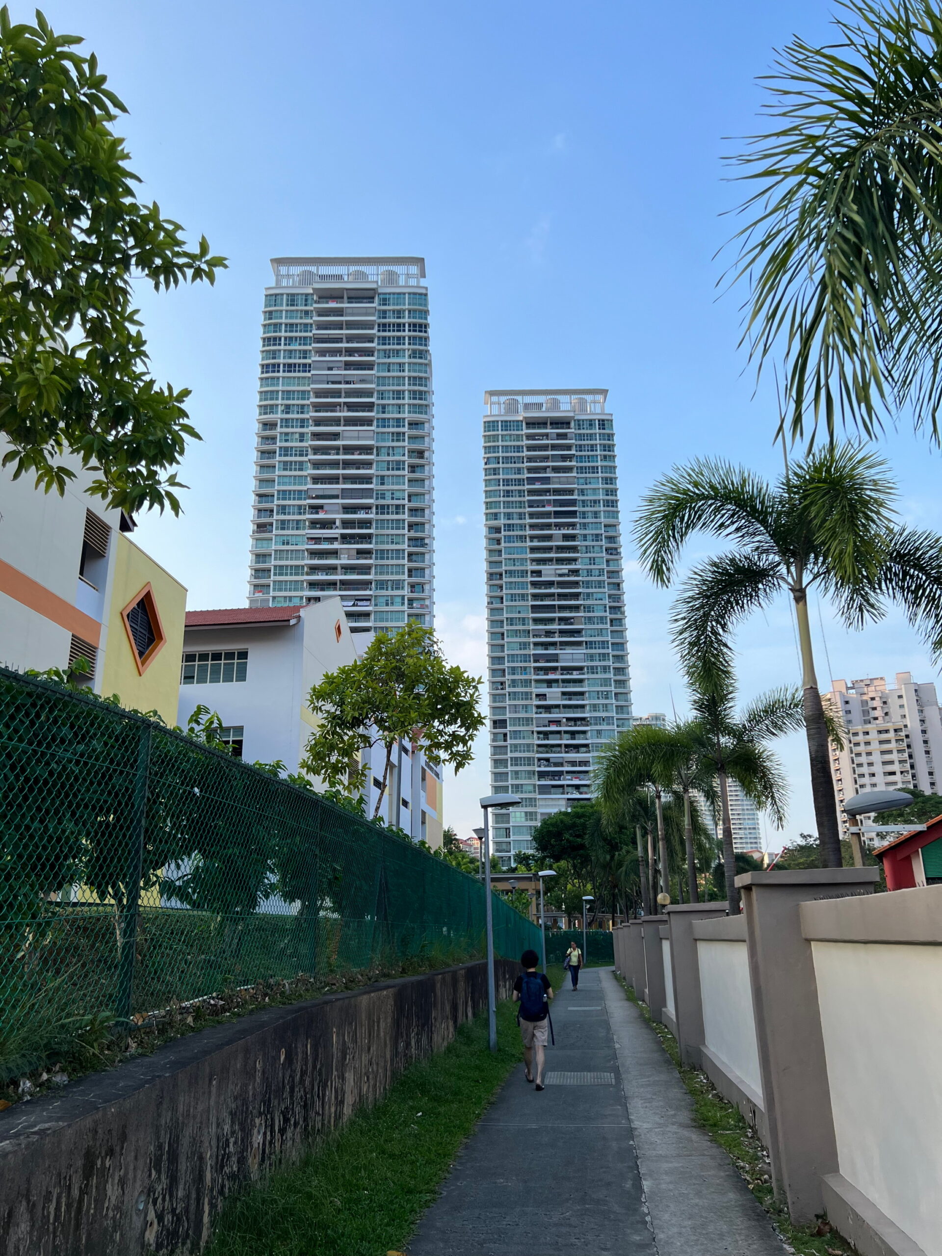
The idea seemed to catch on, because the very next year, another newspaper article was publish noting calls for suggestions for new names for neighbourhoods in Bishan. Again, Shunfu was cited as an example, this time Shunfu Villa, the neighbourhood adjacent to the HDB flats I was walking through, comprising 13 HUDC blocks, which today have been demolished and replaced by a condominium with an unfortunately kitsch name “Jadescape”.
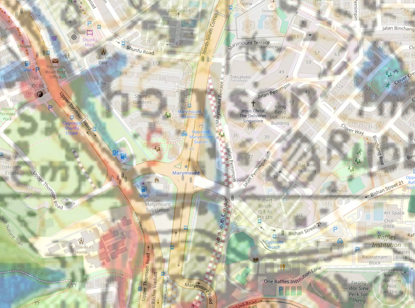
Marymount Road and Jalan Pemimpin
Walking under Block 305 I arrived at Marymount Road, which I crossed using the pedestrian bridge there. Marymount Road has a rather interesting (to me, anyway) history, but I’ll probably wait to write about it another time. Suffice to say the road opened in 1979, to help relieve traffic heading into the city along Upper Thomson Road, but providing drivers with an alternative route bypassing traffic coming from Lornie and Braddell Roads. Drivers were slow to adapt to the new road, but it did eventually seem to do the job. Interestingly, when the road was first announced, it was called Ang Mo Kio Avenue 6. Today, Ang Mo Kio Avenue 6 ends at the junction with Ang Mo Kio Avenue 1 near Bishan-Ang Mo Kio Park and continues southward as Marymount Road from there.

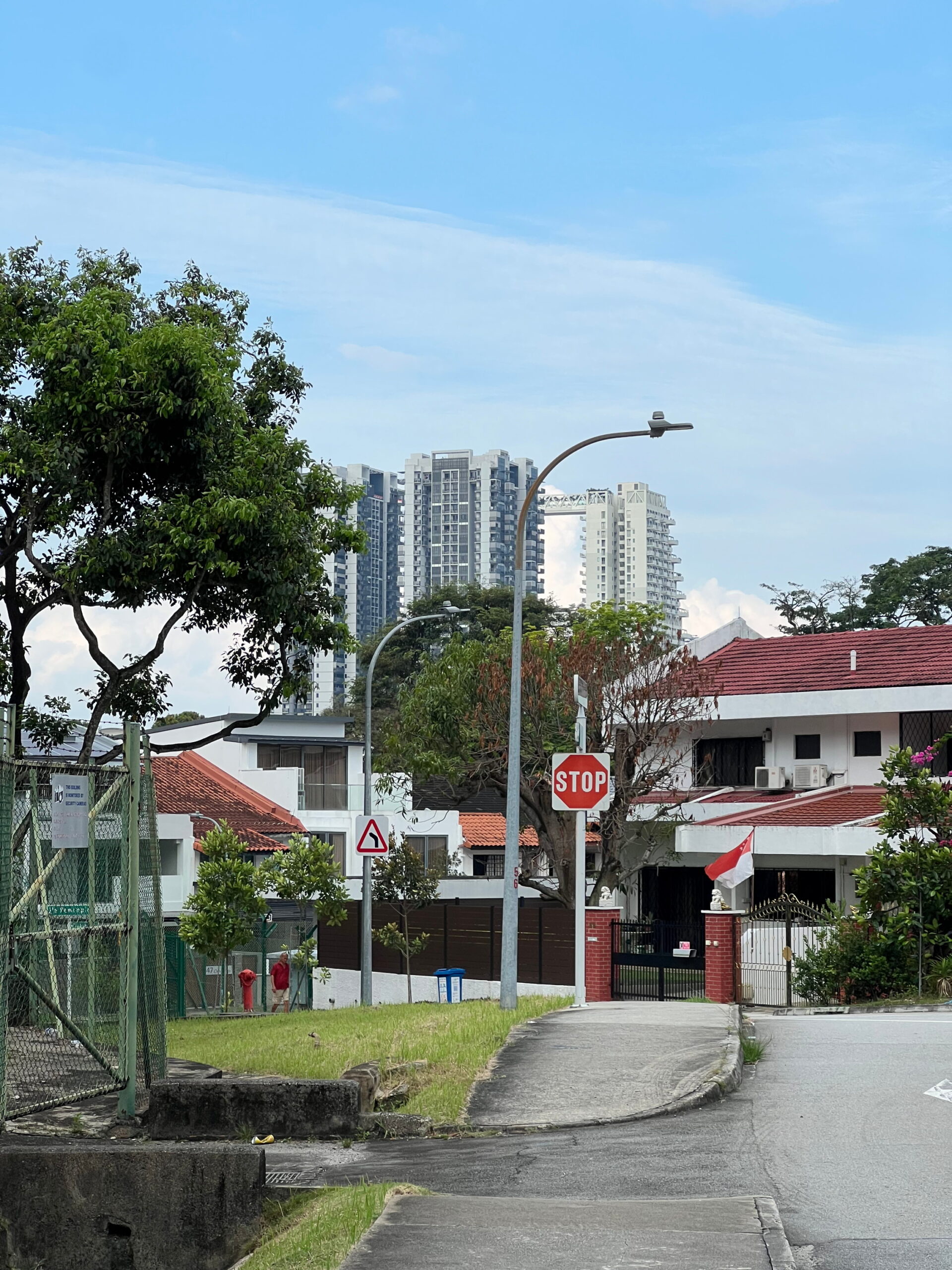
Having crossed Marymount Road, I walked southward along it and followed Bishan Street 21 a very short distance before turning northward again onto Jalan Pemimpin. Jalan Pemimpin is a fairly old road appearing on topographic maps as early as 1953, and possibly existing as a “cart track” before that. The road used to run all the way to Upper Thomson Road, joining it close to where Little Sisters of the Poor used to sit, today called St Theresa’s Home. Those sections of Jalan Pemimpin past Bishan Street 21 and Marymount Road were only progressively expunged as those roads were developed in the mid-80s.
An uncertain history
While looking for old newspaper articles on Jalan Pemimpin, I stumbled upon two articles both described ambitious residential development projects taking place in the area in the 1970s. The first, reported in July 1973, was by a company named Lauw & Sons, which sought to develop 126 two-storey private housing units covering 26 acres. The project was supposedly unique in offering 11 different designs for houses, and was expected to be completed in 1976. The second project, reported in November 1974, was by a company called Arab Investments for Asia Ltd., representing a group of Arab businessmen seeking to develop a $11M shipyard in Sungei Pandan in Jurong, as well as a $40M residential estate in Jalan Pemimpin, comprising 180 semi-detached and terraced houses, expected to be completed also in 1976.
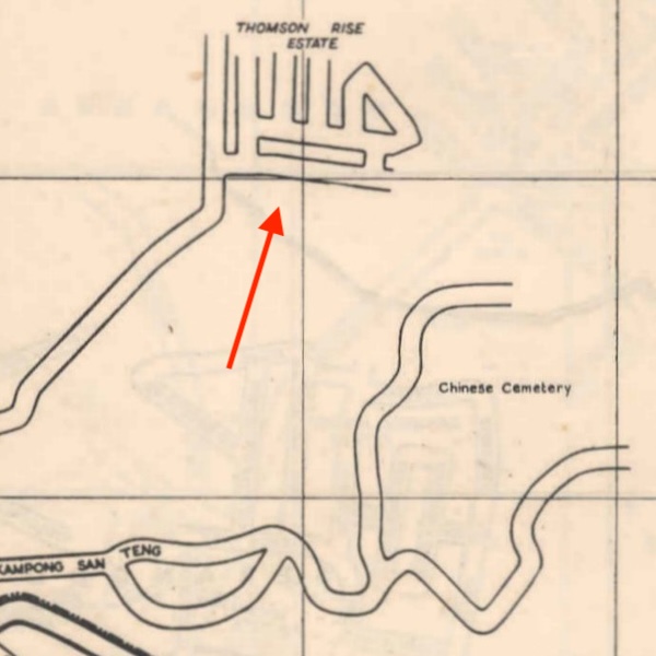
It’s unclear to me how these development projects are related, or whether they might even be the same project under different developers. However, both surprise me because I was under the impression the housing estates around Jalan Pemimpin were older than that. Indeed, Thomson Rise Estate, comprising homes on Jalan Binchang, Jalan Berjaya, Jalan Insaf, and parts of Jalan Pemimpin, appeared in the Singapore Street Map for the first time in 1958, and was mentioned two years earlier, in a real estate advert in the Straits Times in 1956. A later development in the area, Clover Park estate, may have overlapped with the project by Lauw & Sons, having appeared in stages between 1972 and 1983 editions of the Street Map. However, even so, it was advertised in 1968, five years before the report on work by Lauw & Sons.

I’m sure records exist somewhere that will answer these questions, with the Singapore Land Authority (SLA) or some other government agency. If I were doing a more serious investigation, I would probably look there.
A bit of middle class snobbery
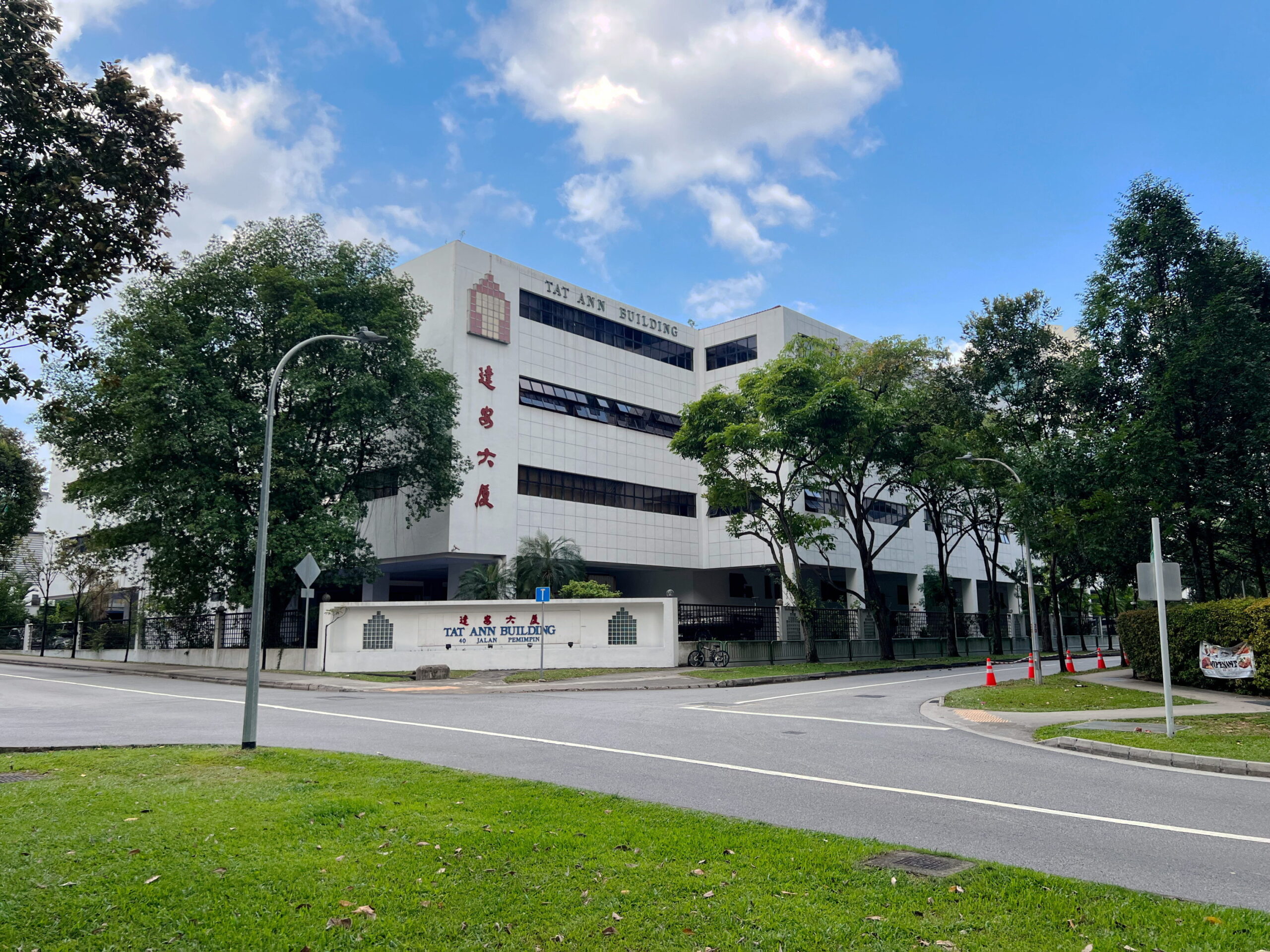
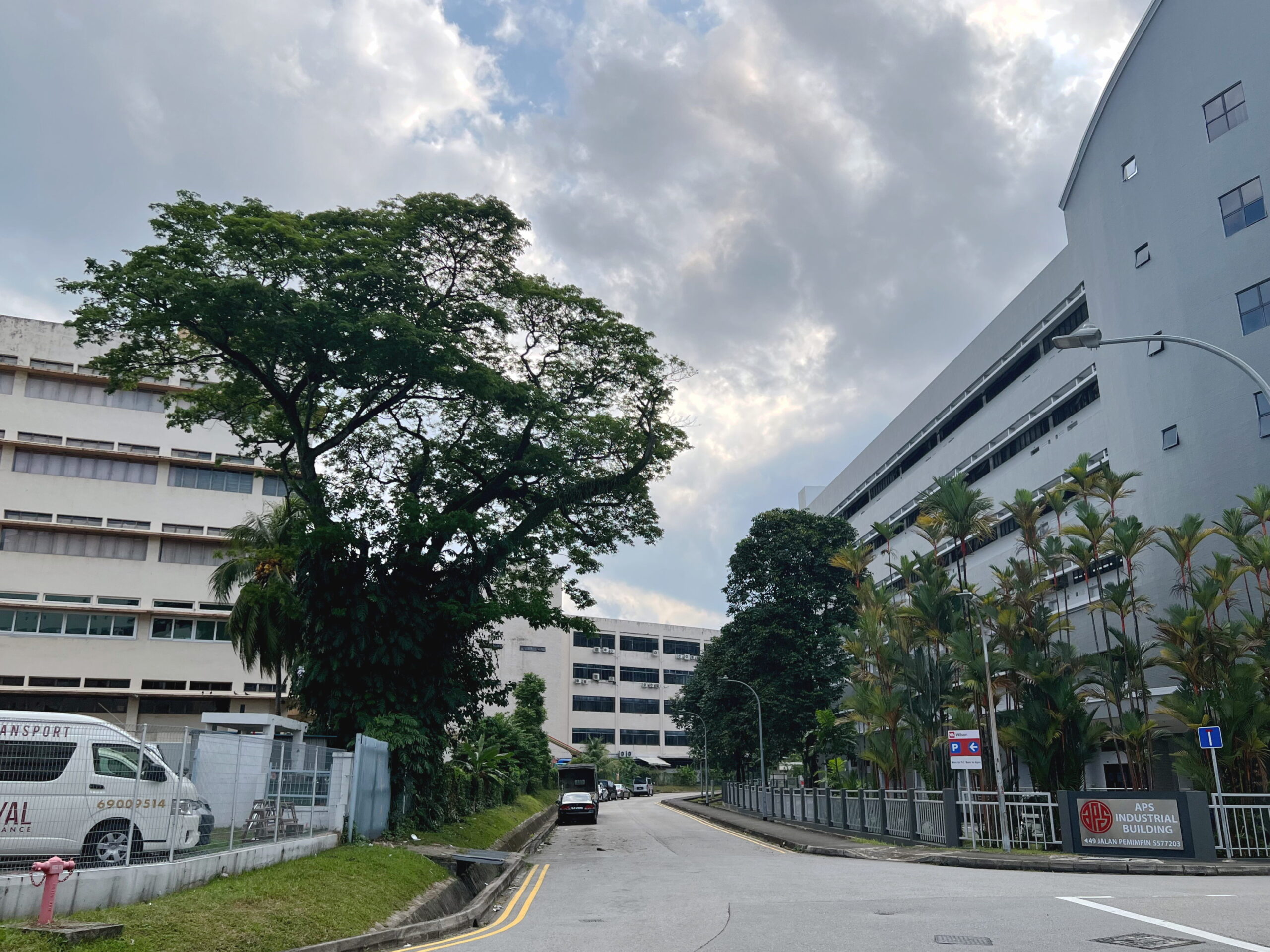
In any case, I headed down Jalan Pemimpin, wandering for a short while amidst the light industrial estate taking up most of the southern end of the road. I do wonder how the residents of Jalan Pemimpin and Clover Park feel about these light factories so close by. An article in an October 1970 edition of the Straits Times does mention complaints about the introduction of light factories in the area, which reported resulted in more mosquitoes.

The same article, describing not only Clover Park but all the private housing estates in the area, stretching all the way up to Windsor Park near Sin Ming, offers up a rather scathing (satirical?) critique of middle class life in these neighbourhoods:
“If the developers have shown a middle-class tendency in their choices of names for their estates, some of the residents have bettered this tendency in the decoration of their homes.
Plastic ducks may not fly across the walls of the sitting-room and plaster gnomes may not stand in the garden, but mosaic tiled driveways and the dividing walls painted in a multiple of hues guaranteed to turn the rainbow green, are some of the local indicators of the existence of more money than taste.”
Wow.
The writer notes that even the squatters who lived in the informal settlements (would these be considered “kampongs”?) dotting the area weren’t necessarily impoverished, some of them owning cars, TV sets, and having “good jobs” because they were “English-educated”.
The write goes on to describe class relations in the area. Relations between the squatters and those middle income residents living in the private housing estates next door were apparently fairly positive (NB: not everyone agrees). However, the older, more established upper middle class residents have this to say about their newer neighbours:
“I’ve lived here for 12 years and the district used to have character, quaint, you know, and the roads were so narrow.
But about five years ago they started to build housing estates. Oh no, it’s not that I object to housing estates as such, but I think the developers should put more imagination into them.”
Snobbery is snobbery whatever the century I guess.
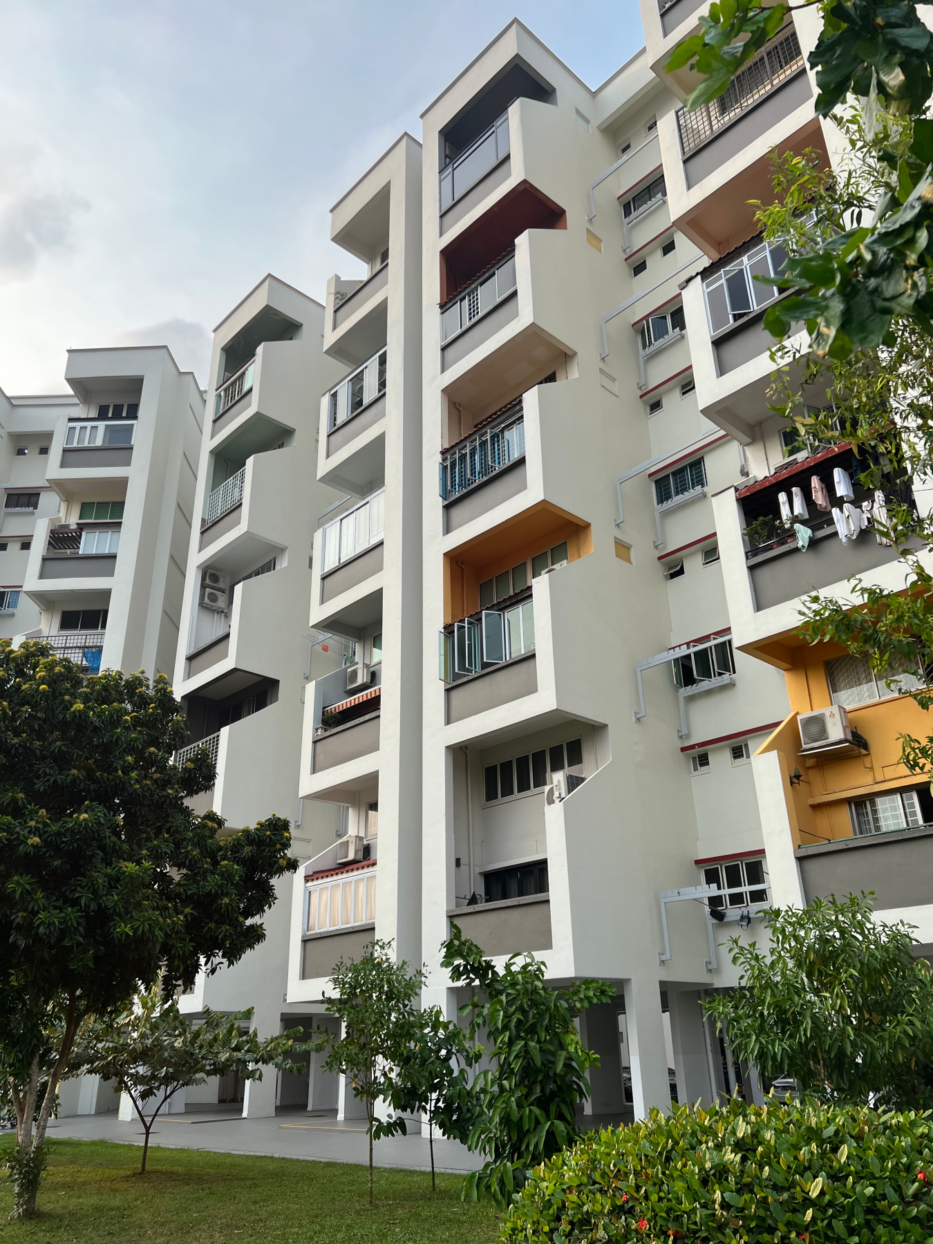
Through Clover Park and Thomson Rise

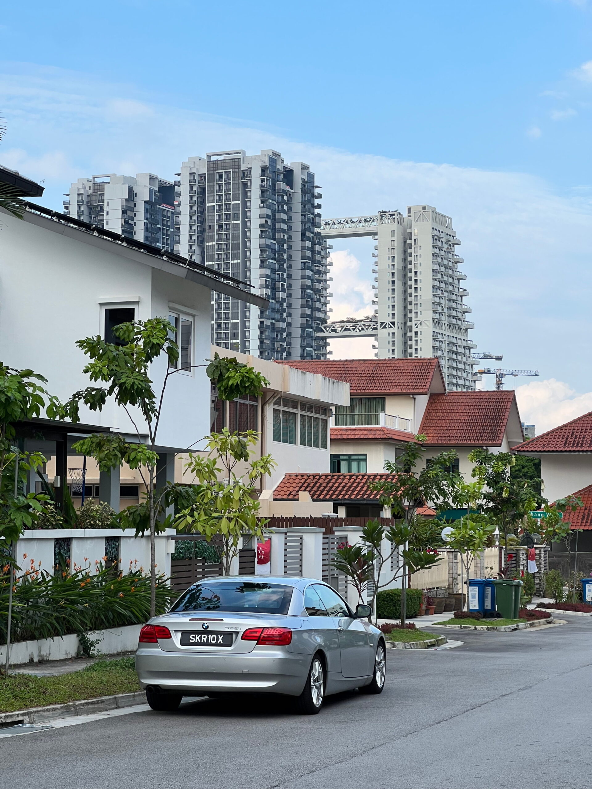
When I was a primary school kid the school bus that took my siblings and I to school used to pass through Clover Park, picking up some students who lived in the estate. I’m not exactly old, but primary school was still a long time ago, and I’m surprised I still remember the layout of the roads from all those years back. I’d gone for a walk in the estate once before, so, not wanting to repeat myself, decided to carve a shorter route through the estate, down Clover Crescent, past the neighbourhood park, and then up Binchang Walk up onto Jalan Binchang.
From there, I crossed the road into Thomson Rise Estate, first walking in a loop around Jalan Insaf, then heading up Jalan Berjaya. I passed by a very multi-ethnic group of boys, literally comprising one Chinese kid, one Malay kid, one Indian kid, and one white kid, looking like a picture from a poster on racial harmony. Just looking around, I wasn’t able to tell this was one of the oldest estates in the area. Most of the houses seemed to have been renovated, if not recently, at least in the past couple of decades. I suppose, as with other formerly middle-income private housing estates, rising property prices have tempted older residents to cash out, bringing in newer residents multiple income brackets above them who want homes that match their wallets.
Everyday magic
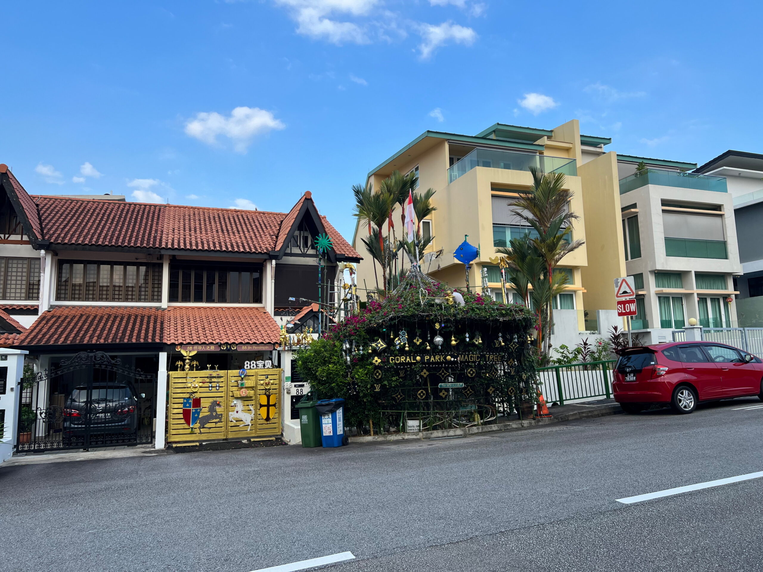
Leaving Thomson Rise, it was back onto Jalan Pemimpin, continuing my way north. Perhaps it’s these houses, which don’t seem to fit cleanly into either Thomson Rise or Clover Park estates, which were developed in the late 70s by Lauw & Sons and Arab Investments for Asia Ltd? I really have no idea. But I passed by a house whose owner had done up his entire front garden to look like a Druid’s lair, with a sign that said “Clover Park Magic Tree”. I didn’t think Clover Park extended this far north, but perhaps it does? In any case, very cool.
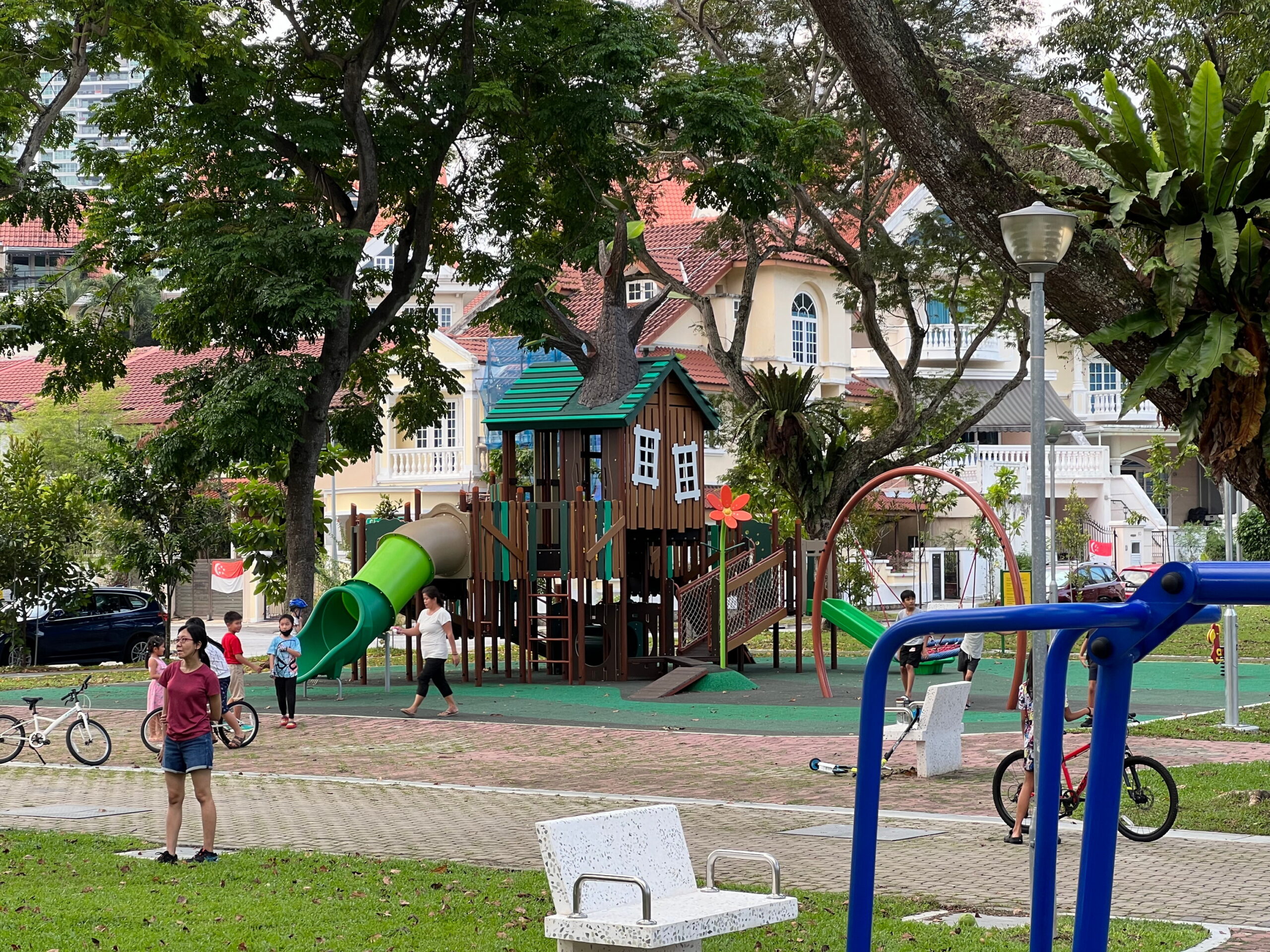
Reaching the end of Jalan Pemimpin, I turned left and headed back down Pemimpin Terrace, turning the corner around Pemimpin Place Playground.
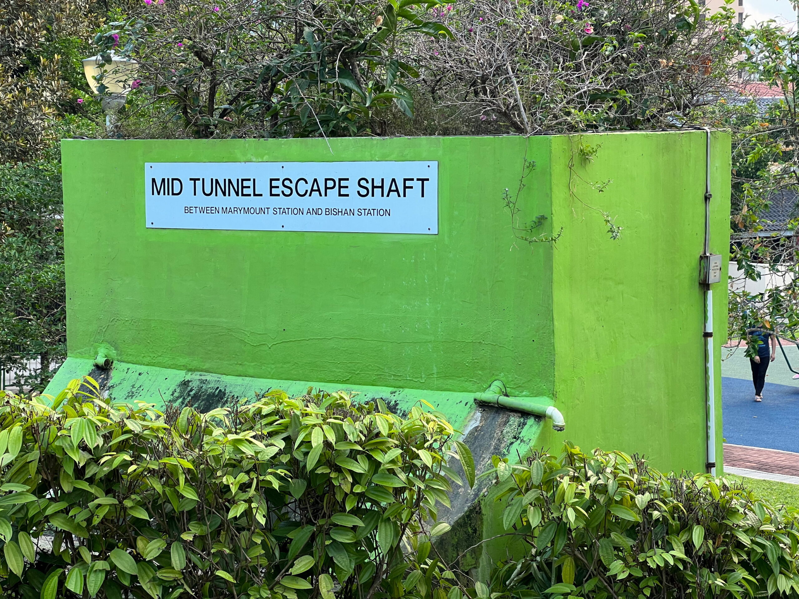
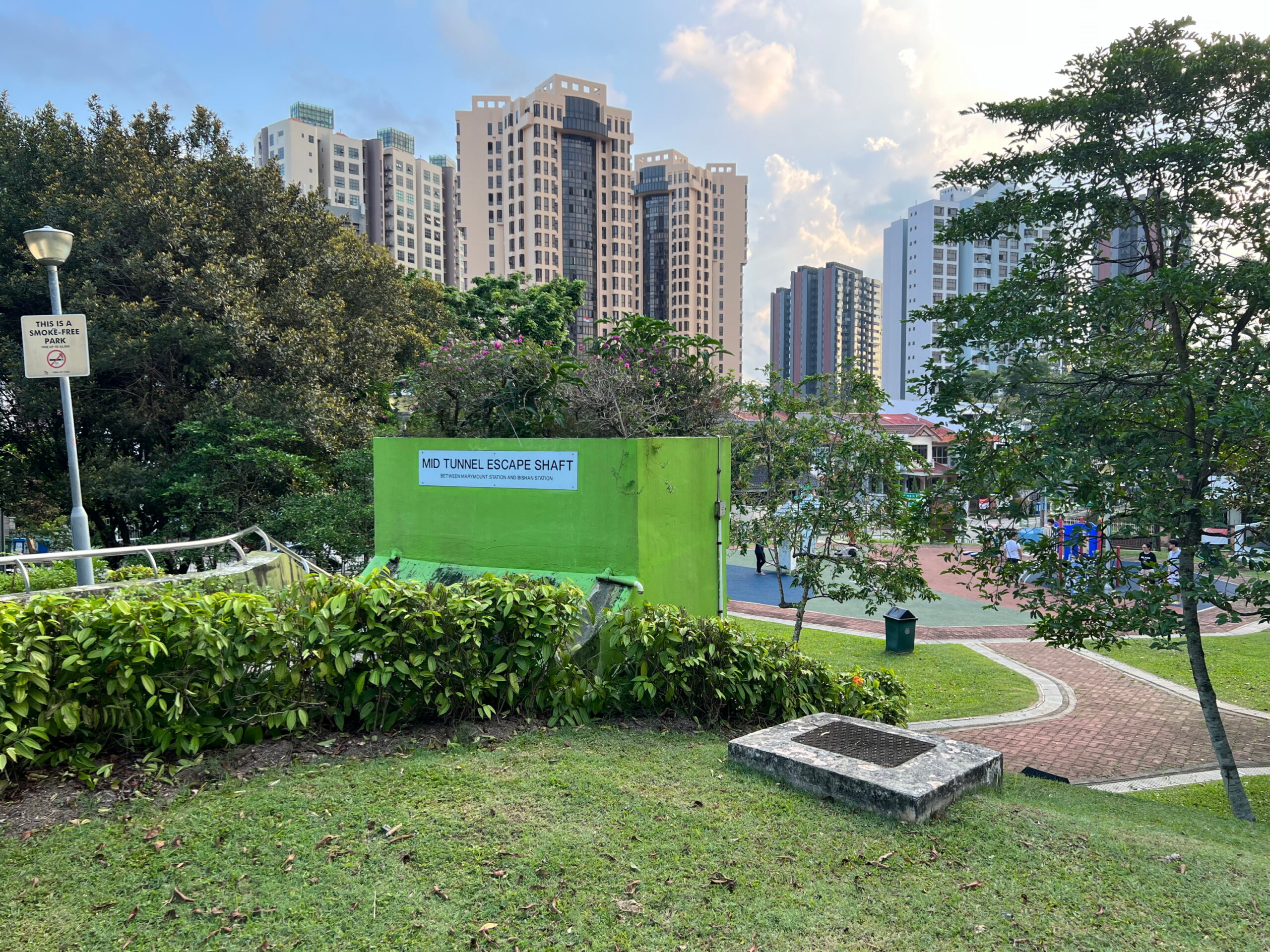
Aside from being a generally nice neighbourhood park, Pemimpin Place Playground is notable for being home to a “Mid Tunnel Escape Shaft”, used for evacuating MRT trains and tunnels in the event of an emergency. LTA has held exercises in the past with students, albeit none with this shaft in particular that I can think of. This one sits on the Circle Line, between Marymount and Bishan stations. Imagine being a kid scurrying around in the playground in the evening after school, and suddenly an entire rush hour train load of people swarms out of a door you barely even noticed between some bushes. It would be like Narnia but in reverse, and less fantastical.

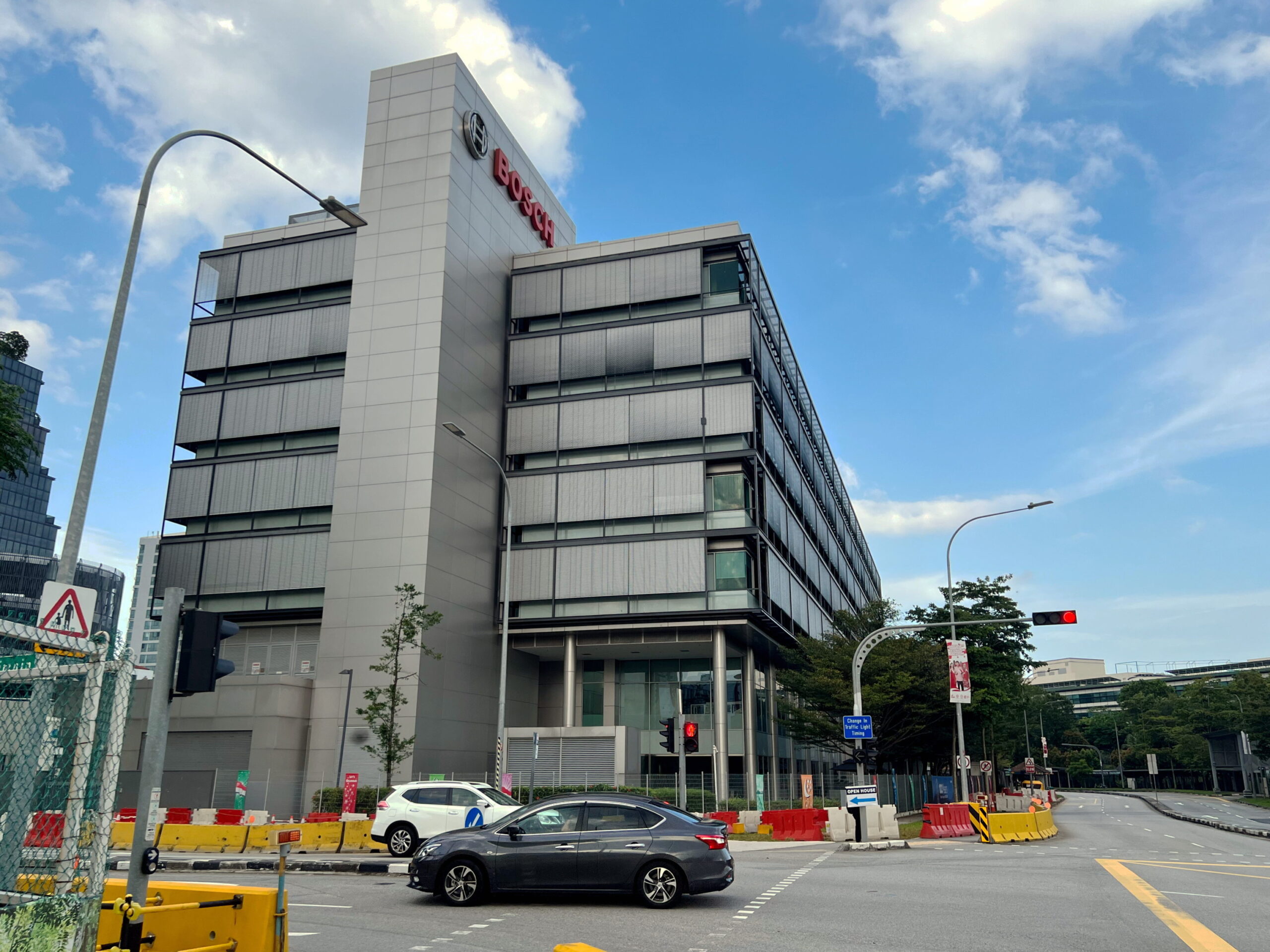
Whitley Secondary School and Catholic High
I circled round the neighbourhood and headed back up to the top of Jalan Pemimpin, turning down an interesting alleyway that I hadn’t even noticed before because it never showed up clearly on any of my maps. This cut a path from Jalan Pemimpin to Bishan Street 24, squished between Whitley Secondary School and Catholic High.

I’ll be honest and say that despite living not far from this area my entire life, I never realised Whitley Secondary was here until only a couple of years ago. The school is so-named because it was originally opened at Whitley Road near where Catholic JC is today, on 1 October 1965, just a couple of months after our independence. It moved to its present location slightly less than 30 years later in March 1992
I’m certain the school must have an interesting history, but unfortunately none of it can be found on their website. They do have a 50th anniversary ebook, but for some bizarre reason they decided to make this an app, which is no longer available for download, and would be nearly impossible to maintain access to in the long-term even if it were still available, because of software and hardware dependencies. Isn’t it a little bit ironic that we record our histories, presumably because we don’t want it to be forgotten, but then neglect to consider how the formats we choose to record those histories in might inhibit remembering?
Catholic High is a brand name school, so I won’t bother writing much about its history. Doubtless there are enough Old Boys out there to tell their own story (or fund a researcher to tell their story for them) that some random bloke on the internet doesn’t have to.
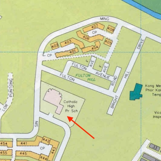
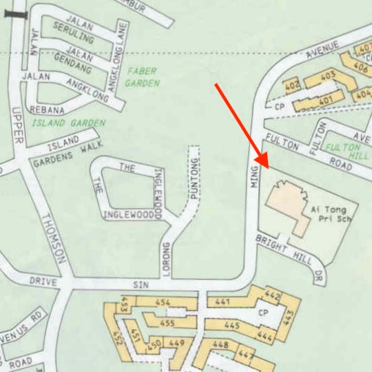
I will say however that I was very interested to learnt that Catholic High Primary was originally meant to be sited at the corner of Bright Hill Drive and Sin Ming Avenue, where Ai Tong School is today! This 1989 New Paper article features pictures of a building which are recognisably Ai Tong today, less the more recent upgrades. Indeed, Catholic High Primary seemed to have moved into that building that very year, only to move again a short while later, in 1992.
This 1992 Straits Times Article describes how, on 2 July that year, 3000 Catholic High students, 2000 from the Primary section and 1000 from the Secondary, walked from their old buildings on Bright Hill Drive and Bishan Street 12 respectively, to their new building on Bishan Street 22, where both still sit today. The even was apparently dubbed “Long March 1992”. It seems crazy to me that anybody could think calling it that would be a good idea. Did they expect to be pursued by nationalists on the way to the new school? Did over 80% of students die on the way? Certainly the article makes it sound like many didn’t have a good time. In any case, Ai Tong’s website says they moved into their current site on 9 July 1992, apparently just a week after Catholic High vacated the premises!
I reached the end of the alleyway and entered what – in my mind – I think of as Bishan proper, although technically everywhere I’d walked thus far from Shunfu onward were in Bishan.
Natura Loft and the DBSS scheme
The first thing I passed by were some towering HDB blocks, part of the Natura Loft development. The development looked quite new to me, but were actually already over a decade old, having been completed in February 2012, according to this Wikipedia article, citing a press release which is no longer accessible.
At the time of its launch in 2008, Natura Loft and other developments like it were described as “condo-style”. These developments took place as part of the Housing Development Board’s “Design, Build, and Sell Scheme” (DBSS). If this sounds at all familiar, you might be thinking of the Geocaching in Tampines post, where I talked briefly about Tampines Neighbourhood 4 being the first HDB development in Singapore to be designed by private architects, as part of the “Design and Build Scheme”.

Indeed the DBSS was an expansion of the Design and Build scheme, allowing private developers to not only design and build flats, but bid for open land tenders, set prices for flats, and market them. Private developers were also given greater freedom when it came to the designs, sizes, types, and configurations of flats. Unfortunately, it seems the DBSS was not a rousing success. Complaints seemed to surround the high prices charged for flats. The Ministry of National Development (MND) reviewed the scheme in 2011 and suspended it that year. Projects already launched prior to this date, including Natura Loft, were allowed to complete, but no new land sales were made under the scheme, and MND confirmed in 2018 that the scheme would not be re-initiated.
Troubles notwithstanding, I have noticed that many regular HDB developments launched in the years that follow have adopted very similar designs. So I wonder if lessons from the development of DBSS flats might have been carried over, in which case perhaps the scheme was a worthwhile exercise anyway.
Bishan North Neighbourhood Park
I finished my walk exploring the area around Bishan North Neighbourhood Park. Just like Whitley Secondary School, I’d lived in the area for decades, and somehow never realised this park was here, nor did I ever think of this part of Bishan as “Bishan North”, but apparently it is. This 1984 Business Times includes a map of Bishan New Town marking the four main neighbourhoods of Bishan, with Bishan East forming the core of what I personally think of as “Bishan”, Bishan North being the bit extending alongside Bishan-Ang Mo Kio Park 2, and Bishan West being essentially Sin Ming. The fourth neighbourhood is simply Shunfu.
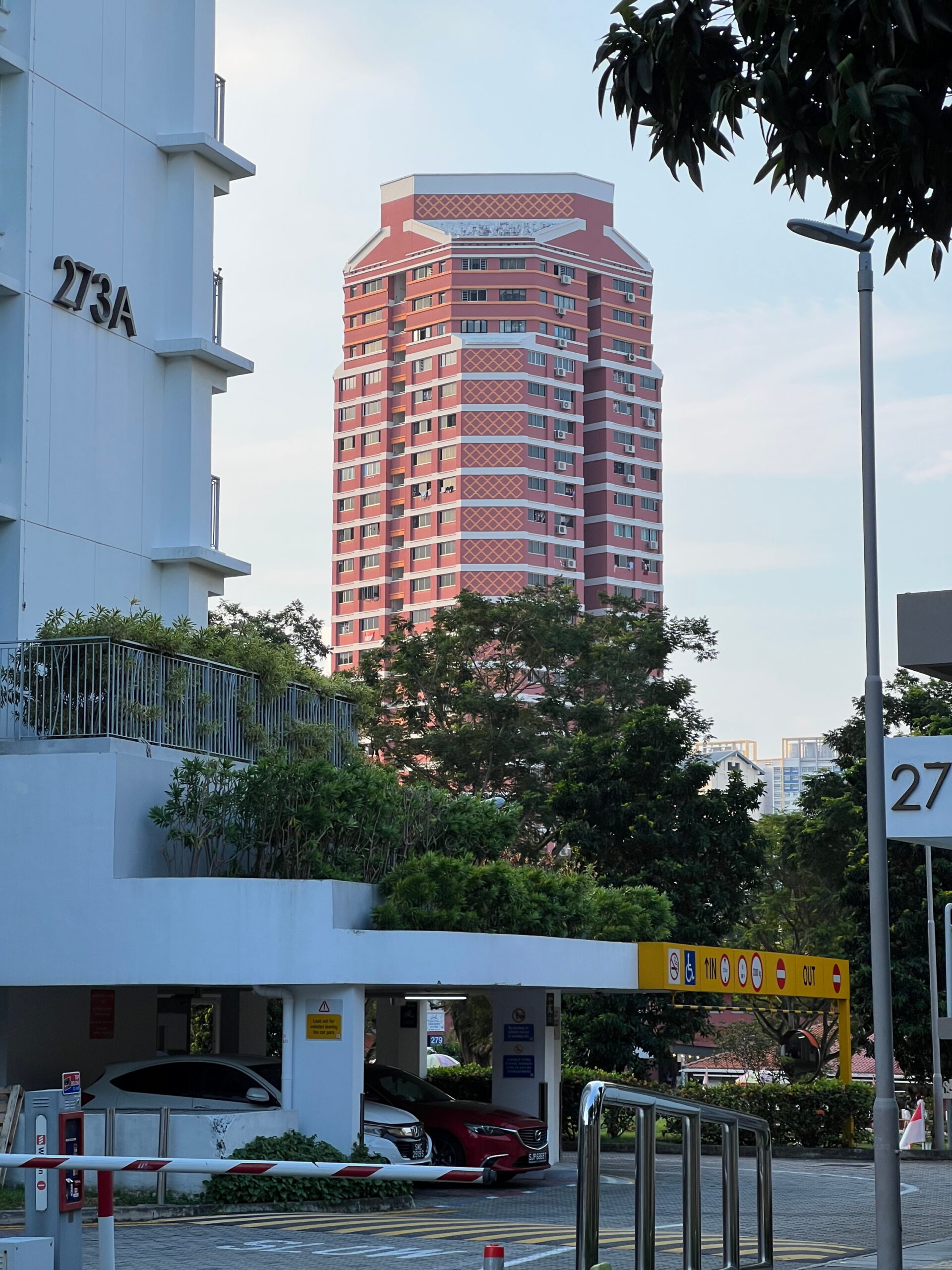

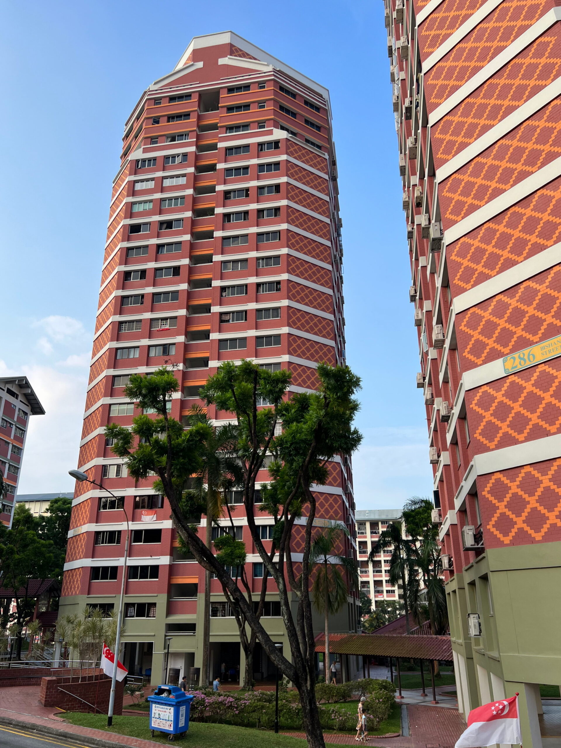
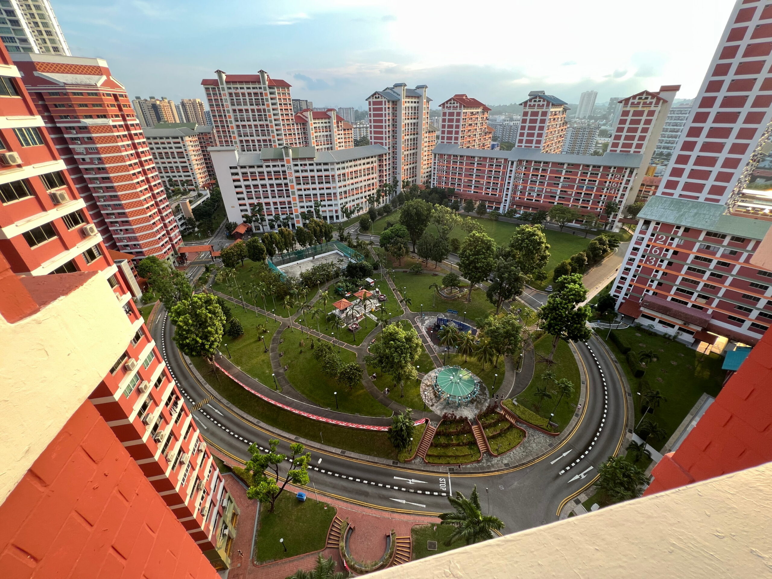
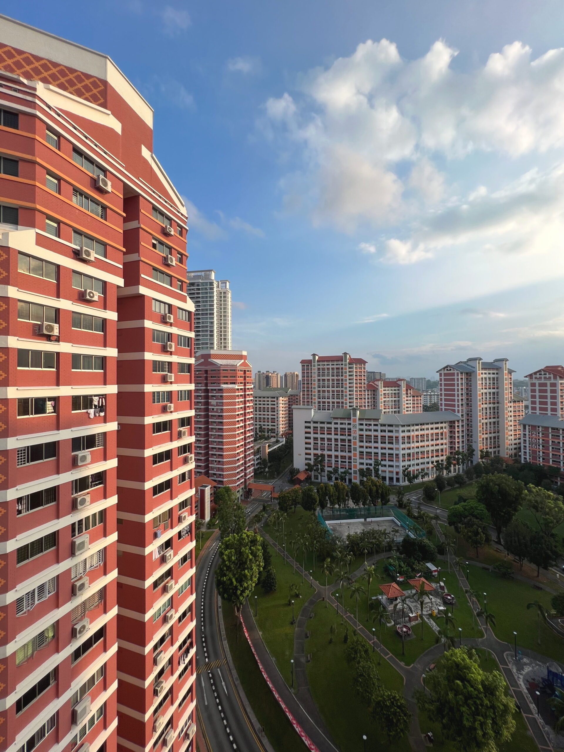
I’m not going to write a lot about Bishan itself. I’ll save the research for when I do a proper walk in Bishan, instead of a walk that merely ends there. I wandered around Bishan North Neighbourhood Park a bit, admiring the unique, octagonal point blocks that stood on its eastern side. The 1984 article I cited earlier did note that each of Bishan New Town’s four neighbourhood incorporated specially-designed blocks that were unique to them, to serve as landmarks. It’s easy to imagine these blocks being landmarks in Bishan North. I don’t believe I’ve seen their like anywhere else in Bishan anyway.
The idea occurred to me that I might take the lift up to the highest floor of one of these blocks to try and get a bird’s-eye view of the Neighbourhood Park and the surrounding area. So I did that, and was rewarded with some great views indeed, particularly as the setting sun cast a golden glow across the neighbourhood.

By this time, it was getting close to dinner, and I had to head back home. The original plan had actually been to walk, via Bishan-Ang Mo Kio Park, but in the end I decided to take the bus instead, rather than risk being late. All in all, this was a short but nevertheless interesting walk through an area familiar to me, and yet about which I have clearly a lot to learn. It’s a walk I’ll probably end up doing again if I ever find myself with a bit of time to spare.
Walk details
- Date: Sunday, 20 August 2023
- Distance: 6.15km
- Time Taken: 1 hour 16 minutes
- Accessibility: Unfortunately, this wasn’t a very accessible walk. It’s mostly my fault, as I didn’t really have a fixed route in mind when I began, and didn’t really think ahead to anticipate accessibility issues. Note especially Shunfu estate, which is broadly accessible, except, annoyingly, there are very few accessible access points to the estate itself. I suggest an alternative route around the estate instead that passes through 3G Park @ Shunfu. Clover Park and Thomson Rise estates are surprisingly accessible. Private estates sometimes aren’t. The sole exception is a stretch of Jalan Pemimpin which may be steep for some. Parts of the final section in Bishan North may be problematic, as I pass through carpark. This is difficult to avoid.
Download KML file for Shunfu, Jalan Pemimpin, and Bishan North walk
Leave a Reply